Raster Calculator QGIS
The Raster Calculator helps you to perform calculations on the basis of existing raster pixel values.
Raster Calculator Options
Four most importance features available in Raster Calculator panel, to executes raster analysis.
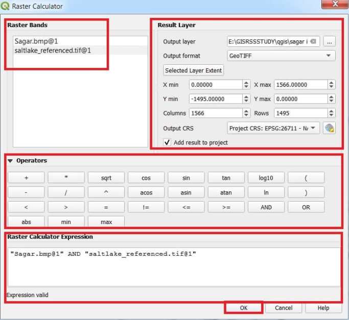
Raster Bands
The Raster bands section loaded all raster layers that can be used. To add a raster to the raster calculator expression field, double click its name in the Fields list. You can use the operators to construct calculation expressions, or you can just type them into the box.
Result Layer
In the Result layer section, you will need to define an output layer. You can define the extent of the calculation area based on an input raster layer, or based on X(latitude),Y(longitude) coordinates and on columns and rows, to set the resolution of the output layer.
Operators
The Operators section contains all available operators. To add an operator to the raster calculator expression box, click the appropriate button. Mathematical calculations (+, -, *, … ) and Trigonometric functions (sin, cos, tan, … ) are available. Conditional expressions (=, !=, <, >=, … ) return either 0 for false or 1 for true, and therefore can be used with other operators and functions.
Raster calculator expression
The Raster calculator expression is the final step to perform calculations.
How to use Raster Calculator in QGIS
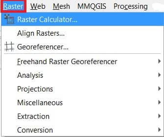
Open Raster Calculator tool in QGIS;
In the Toolbar menu, click on Raster, and open Raster Calculator.
The Raster Calculator window appears, select project Raster data, choose output destination and name, select require operators, finally click OK button.
Now show your result in the Layers panel, and also map canvas in QGIS.