Thiessen Polygons in ArcGIS
In this Tutorial learn, How to Create Thiessen Polygons in ArcGIS Software.
What is Thiessen Polygons?
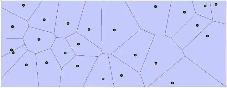
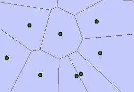
Thiessen polygon contains only a single point input feature. Any location within a Thiessen polygon is closer to its associated point than to any other point input feature.
Thiessen Polygons Method
Thiessen polygon tool is used to divide the area covered by the input point features into proximal zones. These zones represent full areas where any location within the zone is closer to its associated input point than to any other input point.
All points are triangulated into a Triangulated Irregular Network (TIN) that meets the delaunay criterion.
The outside boundary of the output Thiessen polygon feature class is the extent of the point input features plus an additional 10%.
Create Thiessen Polygons in ArcGIS
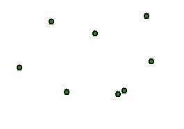
Two types of shapefiles are required to perform this task. i) Point, and ii) Area (polygon).
1. Open ArcMap, and add Shapefiles.
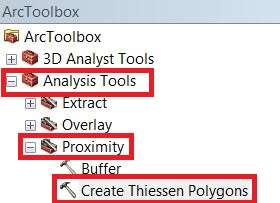
2. Open ArcToolbox, go to Analysis Tools > Proximity > Thiessen Polygons.
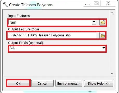
3. In the Input Features section, browse and selecct data (ex.- rain).
4. The Output Feature Class section, go to destination folder and write the valid file name (ex.- Thiessen Polygons).
5. In the Output Field section, choose ALL, and finally click OK button.
Thiessen Polygons Example
Now show your Thiessen Polygon result.