ArcGIS Fire Map
An ArcGIS Fire Map is a dynamic, interactive map created using Esri’s ArcGIS platform to visualize wildfires, fire perimeters, hotspots, smoke plumes, and related emergency data. These maps are often used by emergency responders, forest services, and the public for real-time fire monitoring and decision-making.
The ArcGIS Fire Map Service Maps solution delivers a set of capabilities that help you produce station wall maps and run books for each fire response district and combine them in single map book when necessary.
Fire Station Wall Maps can be produced for individual fire stations or combined into a single station wall map.
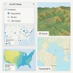
ArcGIS Wildfires Map
- Wildfire Information Map
- US Wildfires
- USA Wildfire Activity – ArcGIS Living Atlas
- Oregon Fires and Hotspots
- BLM California Wildfire Dashboard
- California Fire Perimeters
- Fire and Smoke Hazard Map
Create and explore a wildfires Map
First, you will add a layer from ArcGIS Living Atlas to a web map.
Steps:
1. Sign in to your ArcGIS Online account.
2. On the ribbon, click the Map tab.

[In the pop-up window, click Open in Map Viewer, If necessary.]
3. The Map Viewer opens.
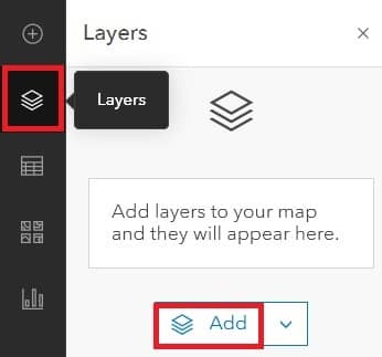
4. On the Contents toolbar, click Layers.
5. In the Layers pane, click the Add button.
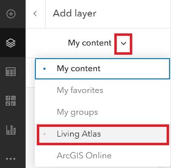
6. In the Add layer pane, click My Content and select Living Atlas.
7. In the search bar, type USA Wildfires, select USA Current Wildfires data, and click the Add button.
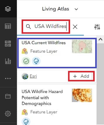
8.In the Layers pane, see the USA Current Wildfires layer is added.
9. On the Contents toolbar, click Basemap, and in the Basemap pane, i suggest choose Dark Gray Canvas.
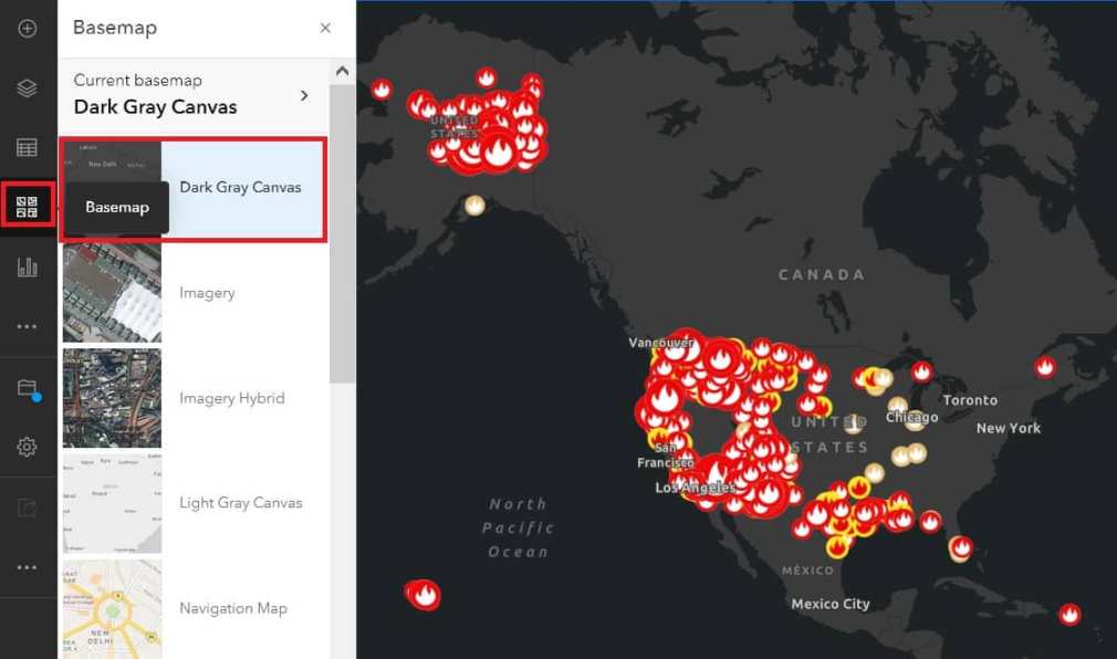
Use zoom and pan tools to explore where the current wildfires are located in the United States country.
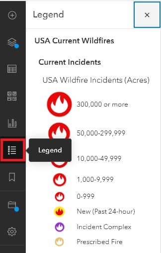
10. On the Contents toolbar, click Legend, to shows what each symbol on the map represents.