Geocoding in ArcGIS Pro
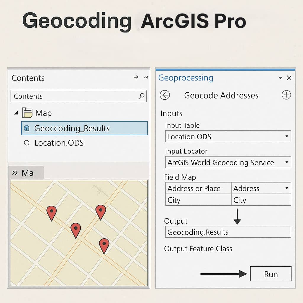
ArcGIS Pro Geocoding process requires a table that stores the addresses you want to geocode, and an address locator or a composite address locator.
This tool matches the stored addresses against the locator and saves the result for each input record in a new point feature class.
When using the ArcGIS World Geocoding Service, this operation may consume credits.
ArcGIS World Geocoding Service requires an ArcGIS organizational account, and it consumes credits. The organizational account must have enough credits to complete the entire geocoding process.
Geocoding Toolbox
he Geocoding toolbox contains tools to assist in accomplishing these tasks.
| Tools | Description |
|---|---|
| Create Composite Address Locator | A composite locator consists of two or more individual locators that allow addresses to be matched using the multiple locators. |
| Create Feature Locator | A locator created to used search for names or unique attributes of your features, such as water meters, short place names, cell towers, or alphanumeric strings used to identify locations. |
| Create Locator | Creates a locator that can find the location of an address or a place, convert a table of addresses or places to a collection of point features, or identify the address of a point location. |
| Geocode Addresses | This process requires a table that stores the addresses you want to geocode and an address locator or a composite address locator. This tool matches the stored addresses against the locator and saves the result for each input record in a new point feature class. |
| Rebuild Address Locator | Rebuilds an address locator to update the locator with the current reference data. Because a locator contains a snapshot of the reference data when it was created. |
| Rematch Addresses | Rematches addresses in a geocoded feature class. |
| Reverse Geocode | The reverse geocoding process searches for the nearest address, place, or intersection for the point location based on optimized distance values for locators created with the Create Locator tool. |
| Split Address Into Components | Splits street address information into address components and creates a table or feature class with the additional components added as unique fields. |
ArcGIS Pro Geocoding Tutorial
In this tutorial, describe how to geocode addresses from tabular data. Geocoding is the process by which tabular data stored as addresses are converted to spatial data as points in a GIS. In this case, we use crime data.
Geocode a Table of Addresses
First Get the data, the data for this tutorial can be downloaded from ArcGIS Online.
Click Download, and save the file your local drive, then Unzip the downloaded file.
Steps :
1. Open ArcGIS Pro.
2. Sign in to ArcGIS Online if you’re not signed in already.
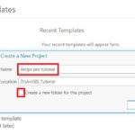
3. On the start page, click Start without any template, create a blank project.
4. On the Insert tab, click New Map  . A new map appears in your project.
5. On the Insert tab, in the Project group, click Add Folder  .
.
6. On the Add Folder Connection dialog box, browse to your project tutorial folder and click OK.
7. If the Geoprocessing tool is not open, on the Analysis tab, click Tools to open the Geoprocessing pane.
8. In the Geoprocessing pane, type geocode addresses in the search box.
9. Click the Geocode Addresses tool  to open the tool in the Geoprocessing pane.
10. Click the Browse button  next to the Input Table box.
11. On the Input Table dialog box, under Project  , click Folders to browse and the .gdb geodatabase data.
12. Click the Browse button next to the Input Address Locator box.
13. On the Input Address Locator dialog box, under Project , click Folders to browse the data.
14. Specify the name and folder where you want to save the output in the Output Feature Class field.
15. Click Run to geocode the table.
ArcGIS World Geocoding Service
To geocode a table of addresses using the ArcGIS World Geocoding Service, an ArcGIS Online for organizations subscription is required.