Interpolation – IDW, Kriging, Natural Neighbor, Spline in ArcGIS
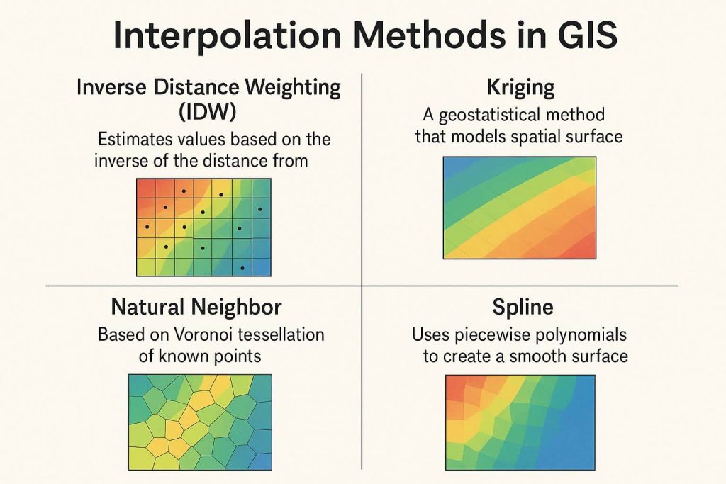
Interpolation methods in GIS commonly used to predict unknown values for any geographic point data, such as elevation, rainfall, chemical concentrations, noise levels, etc.
In this Tutorial, learn How to Interpolate Rainfall Data in ArcGIS, applying 4 methods.
Interpolation Methods
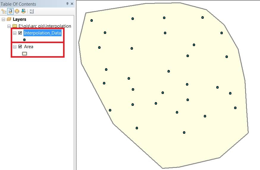
Open a point Data in ArcMap, you can also add Area.
IDW
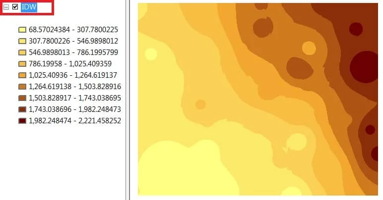
Inverse distance weighted (IDW) interpolation determines cell values using a linearly weighted combination of a set of sample points.
Interpolates a Raster surface from points using an IDW (Inverse Distance Weighted) technique.
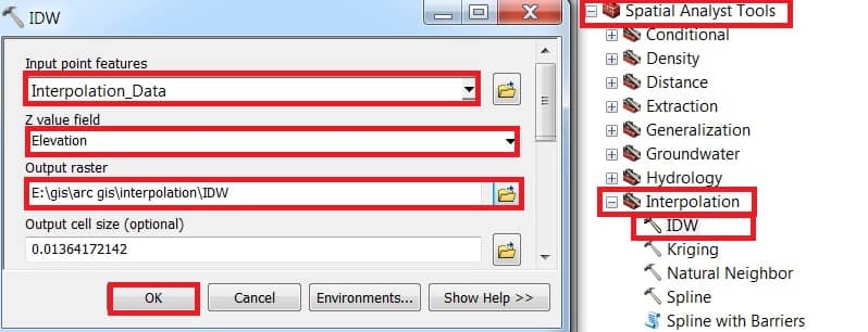
Open ArcToolbox, expand Spatial Analyst Tool > then expand Interpolation and select IDW.
IDW window appears select Input point features data(Interpolation_Data), Z value field select Elevation, then choose Output raster destination. Finally, click the OK button.
Kriging
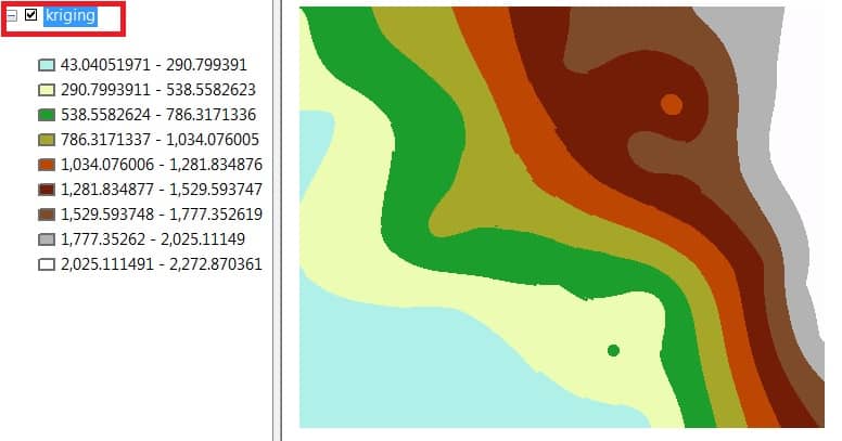
Kriging is an advanced Geo-statistical procedure that generates an estimated surface from a scattered set of points with Z-values.
Interpolates a Raster surface from points using an Kriging technique.
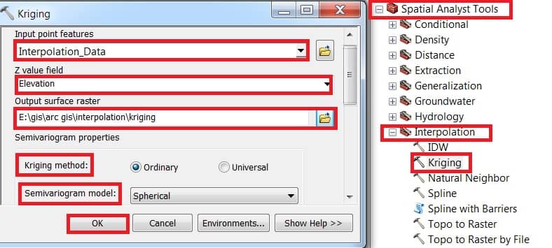
Open ArcToolbox, expand Spatial Analyst Tool > then expand Interpolation and select Kriging.
Kriging window appears select Input point features data(Interpolation_Data), Z value field select Elevation, then choose Output raster destination. Select Kriging method – Ordianary and choose Semivariogram model. Finally, click the OK button.
Natural Neighbor
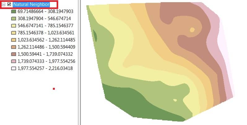
Natural Neighbor interpolation tool finds the closest subset of input samples to a query point and applies weights to them based on proportionate areas to interpolate values.
Interpolates a Raster surface from points using an Natural Neighbor technique.
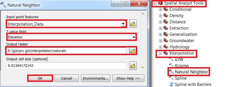
Open ArcToolbox, expand Spatial Analyst Tool > then expand Interpolation and select Natural Neighbor.
Natural Neighbor window appears select Input point features data(Interpolation_Data), Z value field select Elevation, then choose Output raster destination. Finally, click the OK button.
Spline
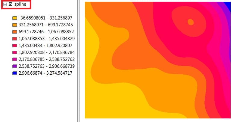
Spline tool uses an interpolation method that estimates values using a mathematical function that minimizes overall surface curvature.
Interpolates a Raster surface from points using an Spline technique.
Open ArcToolbox, expand Spatial Analyst Tool > then expand Interpolation and select Spline.
Spline window appears select Input point features data(Interpolation_Data), Z value field select Elevation, then choose Output raster destination. Finally, click the OK button.





I need to use interpolation, I’m confused about which file type to upload for input point features and Z.
Input point is a particular point of any area (Raw Data), and Z value is indicate to Elevation(Height) Data of this particular point.