Extract and Extraction Tool in ArcGIS
The Extract Tool in ArcGIS is part of the Data Management or Spatial Analyst toolsets.
The Extract tools let you select features and attributes in a feature class or table based on a query or spatial extraction. The output features and attributes are stored in a feature class or table.
ArcGIS Extract Tools
There are four types of extraction tools available in ArcGIS:
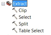
| Tool Name | Description |
|---|---|
| Clip | Extracts input features that overlay the clip features (like a cookie cutter). |
| Select | Extracts features that meet a SQL expression condition. |
| Split | Divides input features into multiple feature classes based on a field. |
| Table Select | Extracts records from a table based on an expression. |
Clip
Extracts input features that overlay the clip features.
Use this tool to cut out a piece of one feature class using one or more of the features in another feature class as a cookie cutter. This is particularly useful for creating a new feature class—also referred to as study area or area of interest (AOI)—that contains a geographic subset of the features in another, larger feature class.
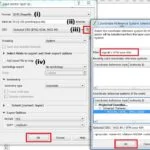
Select
Extracts features from an input feature class or input feature layer, typically using a select or SQL (Structured Query Language) expression and stores them in an output feature class.
Split
Splitting the Input Features creates a subset of multiple output feature classes.The Split Field’s unique values form the names of the output feature classes.
Table Select
Selects table records matching a SQL expression and writes them to an output table.
ArcGIS Extraction Tools
The Extraction tools allow you to extract a subset of cells from a raster by either the cells attributes or their spatial location. You can also obtain the cell values for specific locations as an attribute in a point feature class or as a table.
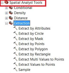
The following table lists the available Extraction tools;
| Tool | Description |
|---|---|
| Extract by Attributes | Extracts the cells of a raster based on a logical query. |
| Extract by Circle | Extracts the cells of a raster based on a circle. |
| Extract by Mask | Extracts the cells of a raster that correspond to the areas defined by a mask. |
| Extract by Points | Extracts the cells of a raster based on a set of coordinate points. |
| Extract by Polygon | Extracts the cells of a raster based on a polygon. |
| Extract by Rectangle | Extracts the cells of a raster based on a rectangle. |
| Extract Multi Values to Points | Extracts cell values at locations specified in a point feature class from one or more rasters. |
| Extract Values to Points | Extracts the cell values of a raster based on a set of point features. |
| Sample | Creates a table that shows the values of cells from a raster, or set of rasters. |