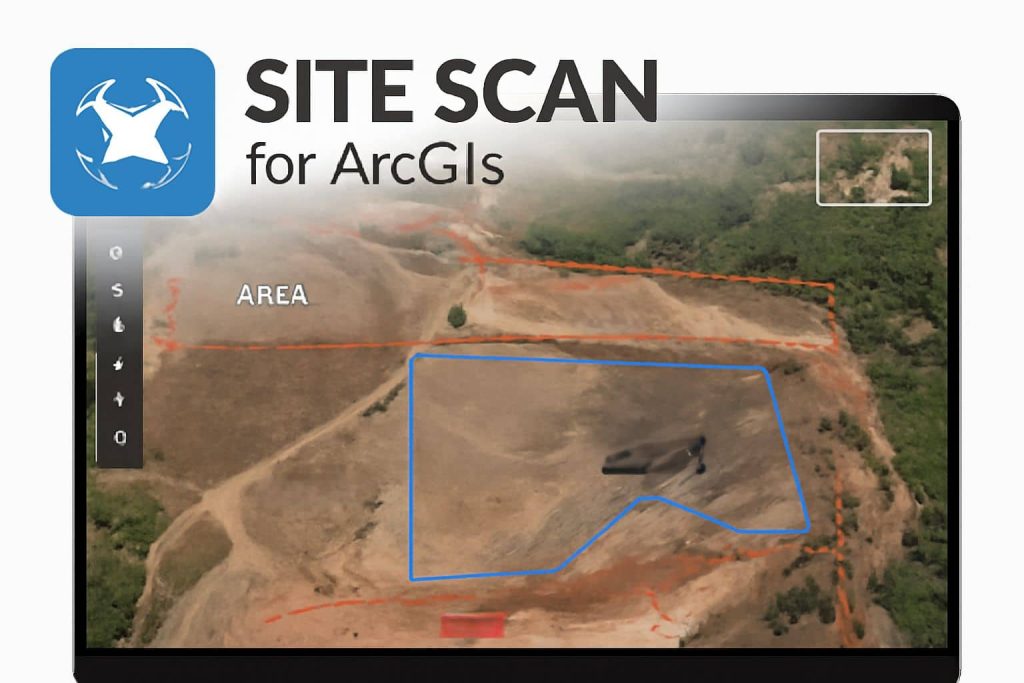
Site Scan for ArcGIS
What is ArcGIS Site Scan?
Site Scan for ArcGIS is the end-to-end cloud-based drone mapping software. It is designed to revolutionize imagery data collection, processing, and analysis.
Its also offers to directly publish your drone data to your ArcGIS organization to perform advanced drone analytics, such as object detection and application of artificial intelligence (AI).
Features
- Data Management: Collect, organize, and store drone data (such as images and videos) in the cloud, making it easy to access and manage remotely.
- Processing: Site Scan processes the raw images from your drone into georeferenced orthomosaics, 3D models, point clouds, and other GIS-ready formats.
- Analysis: You can perform various analyses, like volumetric calculations, site comparison, and change detection over time. This is useful in fields like construction, mining, agriculture, and surveying.
- Integration with ArcGIS: Data collected through Site Scan can be seamlessly integrated into the ArcGIS platform, which allows for further spatial analysis, mapping, and visualization.
How it’s works
- Plan the optimal flight path.
- Execute an autonomous drone flight.
- Upload your data for cloud processing and mark ground control points.
- View 2D/3D outputs on the web.
- Visualize, analyze, and share your data.
- Publish to your ArcGIS organization for advanced analysis.
Drone Data Collection
Site Scan is designed to work with drones, allowing you to capture aerial imagery of a specific site.
- Automated Flights: Pre-programmed flight paths based on the area of interest. This ensures that the drone covers all necessary sections of the area with overlapping images.
- Real-Time Feedback: Some drones with Site Scan integration offer real-time telemetry feedback so you can ensure your flight is proceeding correctly.
Recommended Drones
The best drones to perform Site Scan;
- DJI Matrice 300 RTK with P1 mapping camera
- DJI Phantom 4 RTK with SDK remote controller
- WingtraOne Gen II
- Freefly Astro powered by Auterion
Integration with ArcGIS
One of the main selling points of Site Scan is how well it integrates with the ArcGIS suite. This enables advanced spatial analysis and visualization of drone-captured data, which can be combined with other GIS layers, such as:
- Base Maps: You can overlay the drone data on other GIS layers, such as satellite imagery, parcel data, or demographic data.
- Real-Time Mapping: ArcGIS Online allows you to view the processed imagery in real time and share it with team members.
- Geospatial Analysis: ArcGIS tools like buffer analysis, spatial joins, and proximity analysis can be applied to the drone data, enhancing the scope of your GIS workflow.