ArcGIS Enterprise
What is ArcGIS Enterprise?
ArcGIS Enterprise is a comprehensive, on-premises or cloud-based GIS platform developed by Esri. It enables organizations to create, manage, analyze, and share geographic information within a secure infrastructure.
Enterprise is being turned up to 11, announce ArcGIS Enterprise 11.5, part of the ArcGIS 2022 Q2 releases, is now available to all eligible customers worldwide.
This release will be the first time increased the major version number of ArcGIS Server, now part of ArcGIS Enterprise, in over 10 years.
Highlight Features:
- Enterprise on Windows and Linux includes significant under-the-hood changes in technology.
- Upgrading Server to Enterprise, will require more planning than previous upgrades.
- Prepare for these changes in Enterprise 11.0 by first upgrading to 10.9.1.
What can you do with ArcGIS Enterprise?
- Data management– Real-time data streaming and IoT support (with extensions).
- Mapping, and analysis– Data visualizations with advanced spatial analysis tools.
- Sharing and collaboration– Publish and consume web services (maps, features, imagery).
- Customization and automation– Innovative machine learning workflows using spatial tools and open-source libraries.
Components

- Portal for ArcGIS
- Acts like a private version of ArcGIS Online within your organization.
- Users can share maps, apps, and data securely.
- ArcGIS Server
- Hosts and serves GIS web services (maps, feature services, geoprocessing tools, etc.)
- Supports advanced GIS functions including spatial analysis, geocoding, routing, and more.
- ArcGIS Data Store
- Provides managed data storage (relational, tile cache, spatiotemporal).
- Ensures high performance and scalability for hosted layers.
- Web Adaptor
- Connects your ArcGIS Enterprise to your organization’s web server and allows authentication and load balancing.
Licensing Levels
| Level | Description |
|---|---|
| Basic | View and query maps and services. No editing. |
| Standard | Full-featured editing and geodatabase management. |
| Advanced | Includes advanced analysis and high-end data management. |
| Workgroup | For small deployments (max 10 concurrent users). |
Available Extensions
- Spatial Analyst – advanced raster analysis
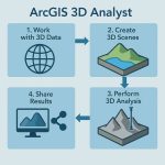
- 3D Analyst – 3D GIS and visualization
- Image Server – large-scale imagery processing
- GeoEvent Server – real-time data feeds
- Notebook Server – Python-based data science and automation
- Mission Server – tactical operations and situational awareness
What’s New in Enterprise 11.0
Enterprise 11.0 introduces full of new enhancements and functionality, new features for data management and administration.
New Features:
- More issues that were fixed at 11.0, see the 11.0 Issues Addressed List.
- Enterprise, release the latest functionality matrix.
- Create Service webhooks, but now it’s beta version.
- ArcGIS Deep Learning Studio is a new app available in Enterprise 11.
- ArcMap-based workflows are no longer supported in Enterprise 11.0.
- The 11.0 software includes ArcGIS Pro– based runtime and does not include ArcMap-based runtime.
Changes in Enterprise 11.0
- Removal of the ArcMap-based runtime
- Move of ArcGIS Enterprise SDK to .NET 6
- Removal of classic Esri Story Map templates
- Removal of ArcGIS Dashboards Classic
- Removal of Presentation for Map Viewer Classic
- Removal of many Configurable App templates
System requirements
Windows Server 2012 is no longer supported by Arc-GIS Enterprise.
The system requirements page for each component, site, and app you deploy, as well as the requirements pages for tools such as Arc-GIS Enterprise Builder or Enterprise SDK. Use the following links to access each page:
- ArcGIS Server
- Portal for ArcGIS
- ArcGIS Data Store
- ArcGIS Web Adaptor
- ArcGIS Enterprise Builder
- ArcGIS GeoEvent Server
- ArcGIS Mission Server
- ArcGIS Notebook Server
- ArcGIS Workflow Manager (Classic)
- ArcGIS Workflow Manager Server
- ArcGIS Knowledge Server
- ArcGIS Enterprise SDK
- Apps supported with ArcGIS Enterprise
Windows operating system requirements
| Supported operating system | Latest update or service pack tested |
|---|---|
| Windows Server 2022 Standard and Data center | May 2022 update |
| Windows Server 2019 Standard and Data center | May 2022 update |
| Windows Server 2016 Standard and Data center | May 2022 update |
Web browsers requirements
The following browsers are supported for most components:
- Google Chrome version 99 and later
- Microsoft Edge version 99 and later
- Mozilla Firefox version 100 and later
- Mozilla Firefox version 91 (ESR)
- Safari version 14 and later
Considerations for upgrades to 11.0
Before upgrading to 11.0 or later, review each retirement notice carefully. You may also consider the benefits of a transitional upgrade to 10.9.1 before directly upgrading to 11.0.
ArcGIS Enterprise portal
The latest release of ArcGIS Enterprise, Map Viewer includes enhancements in its interface and new functionalities. Map Viewer Classic is still available for use in ArcGIS Enterprise 11.0, but is no longer the default for creating web maps in your organization.
Map Viewer highlights include:
- New layer effects
- Create charts
- Sketch enhancements
- Pop-up improvements
Common Use Cases
- City planning and utility management
- Emergency response and disaster planning
- Environmental monitoring
- Logistics and asset tracking
- Infrastructure mapping

