Esri World Imagery
Esri curates thousands of maps, apps, and datasets from authoritative and commercial sources and makes them available to you, ready to use, via ArcGIS Living Atlas of the World.
Access one meter or better aerial and satellite imagery of the world, with political boundaries and placenames. It is widely used in GIS applications for visual context, analysis, and mapping.
You can use this imagery to the ArcGIS Online Map Viewer, ArcGIS Desktop, or ArcGIS Pro. To view this layer with a useful reference overlay, open the Imagery Hybrid web map.
Key Features of Esri World Imagery:
- Global Coverage:
Provides imagery across the globe with varying resolutions depending on the region. - High Resolution:
Resolution ranges from ~15m (global) to sub-meter (urban areas). - Frequent Updates:
Some regions are updated every few months to annually. - Attribution Layer:
Includes metadata showing imagery sources and update dates. - Tile Service:
Available as a tile layer for fast access and smooth panning/zooming. - Supports Integration:
Usable in ArcGIS Online, ArcGIS Pro, QGIS (via plugin), and web apps.
World Imagery Basemap
The World Imagery and Imagery with Labels basemaps contain satellite imagery for the world, with high-resolution aerial imagery added for many areas. These basemaps are part of the default basemap gallery and are among the many basemaps you can choose from to make your own maps.
How to view World Imagery metadata?, follow these steps:
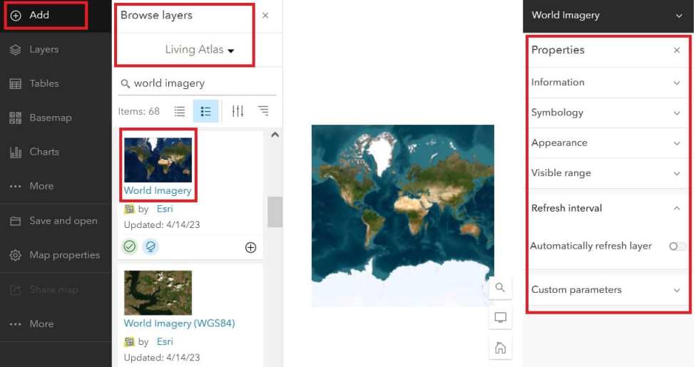
1. Open the Map Viewer, click Add, then Browse Living Atlas Layers.
2. Search for World Imagery.
3. Once you are located, add World Imagery as a layer to your map.
Would you like to add Esri OpenStreetMap? follow the same process.
Imagery Resolution by Zoom Level:
| Zoom Level | Approx. Resolution | Example |
|---|---|---|
| 3–8 | 15–30 meters | Rural, global overview |
| 12–17 | 1–2 meters | Regional detail |
| 18–20 | 0.3–0.6 meters | Urban, high-res detail |
Use Cases:
- Land use/land cover analysis
- Urban planning
- Agriculture monitoring
- Change detection
- Georeferencing maps
- Contextual mapping for GIS apps
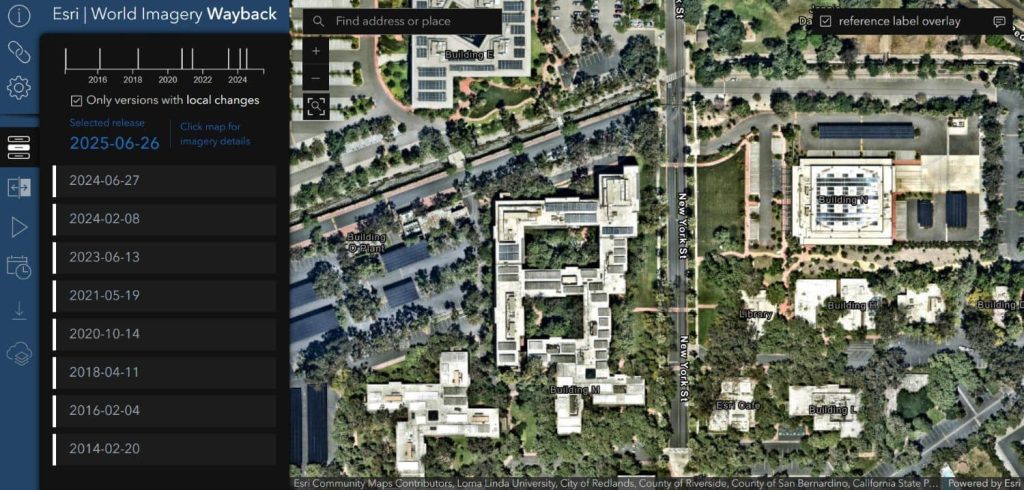
Esri World Imagery Wayback
Esri’s Wayback Imagery is a digital archive of the World Imagery basemap, capturing and storing past versions of the imagery whenever updates are made. It includes metadata on:
- Capture date
- Update date
- Source of imagery
- Coverage area
Use Wayback to Create a Map
Follow these steps to make a map using Wayback.
Step 1 — Open the Wayback app.
Step 2 – Zoom to your area of interest.
Step 3 — Examine the available imagery.
Step 4 — Explore and select the layer(s) you want to add to your map.
Step 5 — Create a web map.