QGIS

QGIS is a Free and Open Source Geographic Information System (GIS) Softtware.

QGIS is available on Windows, macOS, Linux and Android

The current version is QGIS 3.10.2 ‘A Coruña’ and was released. Download and start in below QGIS Tutorial Basic.

In below list of QGIS Tutorial.

QGIS 3D Map view

QGIS 3D

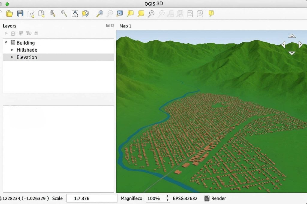
3D Map QGIS QGIS 3D is the three-dimensional visualization tool built into QGIS, a popular open-source GIS software. It allows users to view and interact with terrain, buildings, and other spatial features in a 3D environment, similar to ArcScene or ArcGIS Pro 3D Scene view. Key Features of QGIS 3D View: Create a 3D Scene […]

QGIS 3D Read More »

Orfeo ToolBox

Summary: – This article presents Orfeo Toolbox, how it can be downloaded and used, its integration with Python and QGIS, and how both new and experienced users can take advantage of its full capabilities. Orfeo ToolBox In  the realm of remote sensing and satellite image analysis, Orfeo Toolbox (OTB) is among the most powerful, versatile,

Orfeo ToolBox Read More »

QGIS Python Console

QGIS Python

QGIS Python QGIS is a powerful programming application, that allows you to extend the core functionality of the software, as well as write scripts to automate your tasks. QGIS 0.9 was the first support Python scripting language. There are several ways to use Python in QGIS Desktop: Use the Python API to let the user

QGIS Python Read More »

QGIS 3

QGIS 3

QGIS 3.0 Tutorial QGIS to QGIS 3.0 is a revolutionary change in OSGeo4W. Download QGIS 3 Download the QGIS current version is 3.34.0 ‘Prizren’ released on 27.10.2023. What’s New in QGIS 3.0 Version This release has the following new features: General Expressions User Interface Symbology Digitizing Data Management Forms and Widgets Map Composer Processing Data

QGIS 3 Read More »

QGIS2Web

QGIS2Web Tutorial What is QGIS2Web? QGIS2Web is a plugin for allows you to export your map. If you don’t have your own web server, then QGIS Cloud offers this service with a free version available. QGIS plugin to export your project to an OpenLayers, Leaflet, or Mapbox GL JS web map, so you can view

QGIS2Web Read More »

Scroll to Top