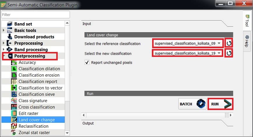
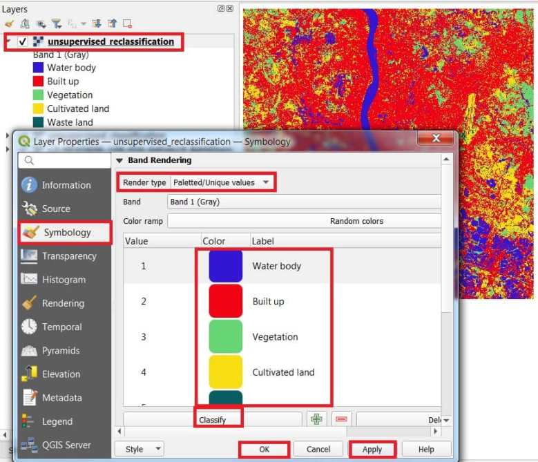
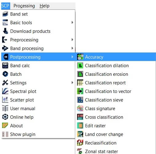
GISRSStudy » QGIS » Page 2

QGIS

QGIS is a Free and Open Source Geographic Information System (GIS) Softtware.

QGIS is available on Windows, macOS, Linux and Android

The current version is QGIS 3.10.2 ‘A Coruña’ and was released. Download and start in below QGIS Tutorial Basic.

In below list of QGIS Tutorial.

Unsupervised Classification in QGIS

Unsupervised Classification Using QGIS Software In this tutorial perform Unsupervised Classification in QGIS Software. Before star the classification, Download a Satellite image. Perform Unsupervised Image Classification Semi-Automatic Classification Plugin Follow this tutorial- How to Install and Manage Semi-Automatic Classification Plugin. Create a Band set 1. Add all the band images (LISS-3) into the QGIS interface. […]

Unsupervised Classification in QGIS Read More »

Post Processing in QGIS

Post Classification Analysis in QGIS In order to improve the image classification results, you can try Post Processing method in QGIS. Perform Post Processing In this tutorial we will apply four Post Processing method in our QGIS Supervised Classification image. Classification Report Classification report allows for the calculation of class statistics such as number of

Post Processing in QGIS Read More »

Supervised Classification in QGIS

Supervised Classification Using QGIS Software In this tutorial perform Supervised Classification in QGIS Software. Before start the classification, Download a Satellite image. Perform Supervised Image Classification Install Semi-Automatic Classification Plugin Now open QGIS and install Semi-Automatic Classification Plugin from the plugin option. [Learn- how to install plugin in QGIS] [Semi-Automatic Classification Plugin– The Semi-Automatic Classification

Supervised Classification in QGIS Read More »

QGIS 3D

3D Map QGIS QGIS offers, creating 3D maps and visualizations is easy and quickly. In QGIS you can create a 3D model in a few simple steps. 1. Add a Data layer that contains 3D data, like a DEM 2. Open a new 3D Map View, go to View manu > New 3D Map View

QGIS 3D Read More »

Orfeo ToolBox

Orfeo ToolBox What is Orfeo ToolBox? Orfeo ToolBox (OTB) is an open-source project for state-of-the-art Remote Sensing. It is a fast image viewer, apps callable from Bash, Python or QGIS, and a powerful C++ API. It can process high resolution optical, multispectral and radar images at the terabyte scale. A wide variety of applications are

Orfeo ToolBox Read More »

Scroll to Top