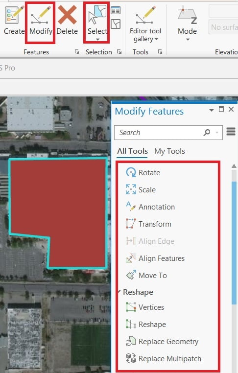
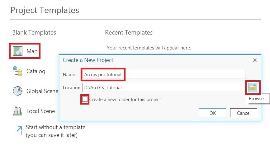
ArcGIS Pro

ArcGIS Pro is the latest professional desktop GIS application from Esri

ArcGIS Pro, you can explore, visualize, and analyze data; create 2D maps and 3D scenes.

In below List of ArcGIS Pro Tutorial.

digitizing in arcgis pro

Digitizing in ArcGIS Pro

Digitization Process in ArcGIS Pro Digitize Feature and Customize 1. Feature class creates is done, drag it and add to Contents pane. Now select the Edit tab, choose to Create ribbon, create a feature window appears and start Digitizing process in ArcGIS Pro. 2. Remember one thing, setting Snapping option (snapping is on, ‘XY’ tolerance 10 pixels). Perform digitize then you can

Digitizing in ArcGIS Pro Read More »

ArcGIS pro layout view

ArcGIS Pro Layout View

Layout in ArcGIS Pro Layout View in ArcGIS Pro is used to design map compositions for printing or exporting. It lets you combine your maps, legends, scale bars, north arrows, and text into a professional layout In this tutorial, we will create a layout view using ArcGIS Pro application. Create a Blank Layout You can

ArcGIS Pro Layout View Read More »

Scroll to Top