Summary: – In this tutorial we will learn, what is Georeferencing? Concepts, Methods, and Applications, Types of Georeferencing, Understanding Georeferencing in GIS: QGIS, and ArcGIS.
Georeferencing: Concepts, Methods, and Applications
What is Georeferencing?
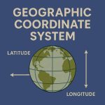
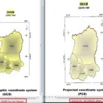
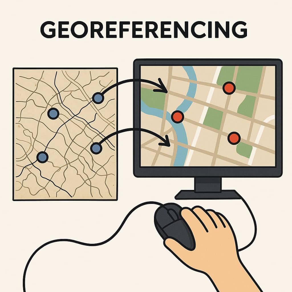
Georeferencing is the process of assigning real-world Coordinates (Latitude and Longitude) to a raster image or dataset so that it aligns correctly with a Geographic Coordinate System (GCS). It is an essential step in Remote Sensing (RS) and Geographic Information Systems (GIS) to ensure spatial accuracy and integration of various datasets.
Georeferenced refers to the process of assigning map coordinates to image data. The image data may already be projected on to the desired plane, but not yet referenced to the proper coordinate system. Georeferencing corrects this by matching the image to know geographic points. Image-to-image rectification involves georeferencing only if the reference image is already Geo-referenced.
Why Georeferencing Important?
- Accuracy: Ensures that satellite images and maps correctly represent real world locations.
- Data Integration: Allows combining different spatial datasets for analysis.
- Change Detection: Helps compare historical and recent satellite images for monitoring environmental changes.
- Mapping and Visualization: Enables the creation of accurate maps and models for decision-making.
Process of Georeferencing
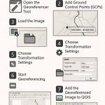
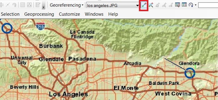
The process begins by loading the raster and vector layers in GIS Software (e.g.- QGIS or ArcGIS). Using the Georeferencing tool, control points (GCPs) are added by matching known locations on the image with corresponding points in the vector file. A transformation method (e.g.- Polynomial, Thin Plate Spline) is applied, followed by selecting the appropriate coordinate system. The georeferenced image is then saved and verified by overlaying it with vector data. This ensures accurate spatial alignment for GIS analysis and mapping.
Step I: Collecting Control Points–
To accurately align the image with real-world coordinates, Ground Control Points (GCPs) are selected. These are well-defined locations that are clearly visible on both the image and the reference map. Ideal control points include road intersections, river junctions, building corners, and other distinct landmarks. The more precise the control points, the better the georeferencing accuracy.
Step II: Assigning Coordinates–
Each selected control point is assigned real-world coordinates, typically using GPS data, an existing georeferenced map, or a vector file. These coordinates are in latitude-longitude or another coordinate reference system (CRS). The more control points added, the more reliable the transformation will be.
Step III: Applying a Transformation–
To align the image with the reference map, mathematical transformations are applied:
- Affine Transformation– Adjusts for scaling, rotation, and shifting (useful for simple distortions).
- Polynomial Transformation – Corrects complex distortions by using higher degree equations.
- Spline Transformation – Warps the image like a flexible sheet, useful for old or distorted maps.
The chosen transformation method depends on the level of distortion in the image.
Step IV: Resampling the Image–
Once the transformation is applied, the image pixels need to be recalculated and adjusted to fit the new coordinate system. This is called resampling, and it ensures that the image retains its quality and accuracy. Common resampling methods include:
- Nearest Neighbor – Maintains original pixel values (best for categorical data like land use).
- Bilinear Interpolation – Averages nearby pixels for a smoother image.
- Cubic Convolution – Produces higher-quality images by considering more surrounding pixels.
Step V: Validation–
To ensure the georeferenced image is accurate, it is overlaid on existing GIS data (such as a shapefile). Validation methods include:
- Visual Inspection – Checking if roads, rivers, and landmarks align properly.
- RMS Error Calculation – Measures the difference between the control points on the image and the reference map (lower error values mean better accuracy).
- Adjustments – If misalignment is found, more control points can be added, or a different transformation can be used.
Once the image is validated, it is saved in a GIS-compatible format (e.g., GeoTIFF) and can be used for mapping, analysis, or further geospatial applications.
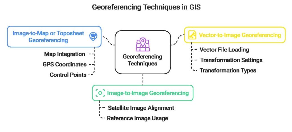
Types of Georeferencing
- Image Georeferencing– Aligns a satellite image with another georeferenced image.
- Map/ Ground Georeferencing– Aligns a satellite image with a map containing real-world coordinates.
- Vector Georeferencing– Load the vector file (shapefile, geojson) and image (TIFF, JPG, PNG) in GIS software and then enable Georeferencing Toolbar.
Georeferencing in GIS
The term is commonly used in the Geographic Information Systems field to describe the process of associating a physical map or raster image of a map with spatial locations. In this case, GIS Software helps you rectified or unreferenced image to convert rectified or referenced image.
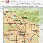
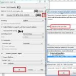
Georeferencing in QGIS
Georeferencing in ArcGIS
Applications of Georeferencing in RS and GIS
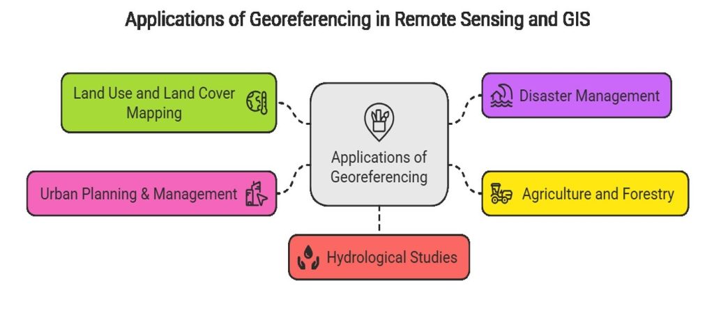
- Agriculture and Forestry: Monitoring crop health, forest cover, and soil conditions.
- Land Use and Land Cover Mapping: Identifying changes in vegetation, urban expansion, and deforestation.
- Urban Planning & Management: Aligning satellite imagery with city maps for infrastructure development.
- Disaster Management: Mapping flood zones, landslides, and earthquake prone areas.
- Hydrological Studies: Tracking river changes, lake boundaries, and water resource management.
Conclusion
This process is essential for aligning satellite images, scanned maps, and aerial photographs with existing geospatial data. By georeferencing, different spatial datasets can be integrated, analyzed, and visualized accurately, leading to better decision-making in various fields such as urban planning, disaster management, environmental monitoring, and infrastructure development. Georeferencing enhances data interoperability, allowing seamless comparison of historical and modern maps, tracking land-use changes, and improving GIS-based modeling.