QGIS

QGIS is a Free and Open Source Geographic Information System (GIS) Softtware.

QGIS is available on Windows, macOS, Linux and Android

The current version is QGIS 3.10.2 ‘A Coruña’ and was released. Download and start in below QGIS Tutorial Basic.

In below list of QGIS Tutorial.

Installing QGIS on MacOS

QGIS Macbook

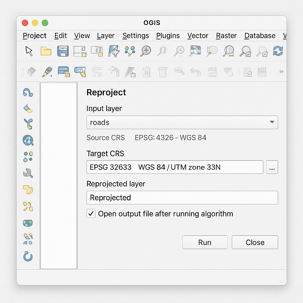
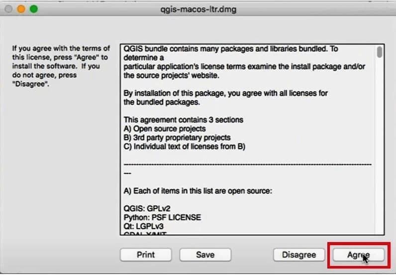
QGIS MacBook QGIS is fully supported on macOS you can download Software on MacBook. Download QGIS Mac Official All-in-one signed installers for macOS High Sierra (10.13) and newer can be downloaded. Installing QGIS on MacOS To install QGIS on Mac follow the below steps: 1. Check the downloads folder in your system and open it. […]

QGIS Macbook Read More »

QGIS Reproject

QGIS Reproject

QGIS Reproject Layer Reprojecting a layer in QGIS means transforming its coordinates from one CRS to another. This is useful when combining datasets with different spatial references or when preparing data for analysis or export. The CRS (Coordinates Reference System) of data, as well as the map right WGS84, this is a very common Geographic

QGIS Reproject Read More »

QGIS Advanced Digitizing Toolbar

Advanced Digitizing Toolbar QGIS In the tutorial perform Advanced Digitization in QGIS, using Digitizing tool and Advanced Digitizing toolbar. Activated Advance Digitizing Tool Enable Advanced Digitizing toolbar, in the Toolbar menu, click on View, hover Toolbars, and click Advanced Digitizing toolbar checkbox. If not activated Digitizing Toolbar and Snapping Toolbar, also click in this two

QGIS Advanced Digitizing Toolbar Read More »

qgis data source manager

QGIS Data Source Manager

Data Source Manager QGIS In QGIS the Data Source Manager toolbar offers all the necessary layers/tools. It is a central tool in QGIS used to load and manage geospatial data from various sources. It allows users to connect to databases, open vector/raster files, web services, and more—all from one interface. Data Source Manager toolbar provide

QGIS Data Source Manager Read More »

Add KML File to QGIS

Add KML & KMZ File to QGIS In this tutorial we will discuss three lesson: How to open KML file in QGIS 1. Open QGIS application. 2. From the Layer menu select Data Source Manager. 3. The data source manager window will appear, on the left panel, select Vector. 4. In the right side the

Add KML File to QGIS Read More »

Scroll to Top