POLARIS GIS
POLARIS offering a wide spectrum of GIS, remote sensing, mapping, and data analysis services to public and private sector clients both domestically and internationally.
What is POLARIS GIS?
POLARIS is a specialist consultancy offering a diverse range of geospatial services to private and public sector clients in the UK and internationally. It is to utilize a variety of geospatial technologies to provide cost effective and industry leading solutions.
Features:
- Geographic Information Systems (GIS)
- Computer Aided Design (CAD)
- Web & Cloud based Geo-spatial Platforms
- 3D Visualization Tools
- Global Positioning Systems (GPS)
- Building Information Modelling (BIM)
Key Services Offered by POLARIS
| Service Area | Description |
|---|---|
| Geospatial Analysis | Spatial data modeling, spatial statistics, and location-based insights. |
| GIS Mapping & Cartography | High-quality custom maps for planning, infrastructure, and reporting. |
| Remote Sensing | Satellite/aerial image processing for land cover, change detection, etc. |
| Geospatial Software Development | Custom web GIS, mobile mapping apps, and spatial database solutions. |
| Data Management & Conversion | Cleaning, transforming, and integrating geospatial datasets. |
| Environmental & Planning Support | Mapping for EIA, LULC, flood risk, and urban planning. |
POLARIS is focused on projects in the urban and built environment where we work with many professional disciplines, including architects, civil engineers, economists, environmental consultants, hydrologists, legal personnel, surveyors, sustainability consultants, transport planners and urban designers, and a few more.
POLARIS has proven experience working with world class multi-disciplinary teams on some of the most challenging urban planning and infrastructure projects to be found anywhere on the planet. It’s work across all scales from national and regional, cities and towns, campuses and neighborhoods down to individual residential, commercial and mixed-use developments.
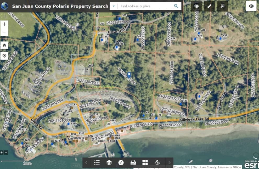
San Juan County Polaris Property Map