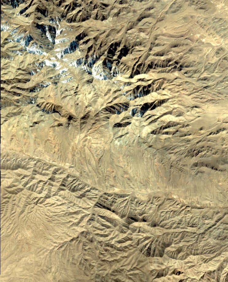
IKONOS Satellite
IKONOS Satellite was launched in September 1999. IKONOS panchromatic Sensor resolution is 1 m, and multispectral scanner resolution is 4 m. The swath width is 13 km at nadir. Accuracy with out ground control is 12 m horizontally, and 10 m vertically; with ground control it is 2 m horizontally, and 3 m vertically.
The orbits at an altitude of 423 miles, or 681 kilometers. Revisit time is 2.9 days at 1 m resolution, and 1.5 days at 1.5 m resolution.
IKONOS Satellite Sensor
It was a high-resolution imagery at 1- and 4-meter resolution. It collected Multispectral (MS) and Panchromatic (PAN) imagery.
Satellite Specifications
| Launch Date | 24 September 1999 at Vandenberg Air Force Base, California, USA |
| Operational Life | Over 7 years |
| Orbit | 98.1 degree, sun synchronous |
| Speed on Orbit | 7.5 kilometers per second |
| Speed Over the Ground | 6.8 kilometers per second |
| Revolutions Around the Earth | 14.7, every 24 hours |
| Altitude | 681 kilometers |
| Resolution at Nadir | 0.80 meters panchromatic; 3.28 meters multispectral |
| Resolution 26° Off-Nadir | 1.0 meter panchromatic; 4.0 meters multispectral |
| Image Swath | 11.3 kilometers at nadir; 13.8 kilometers at 26° off-nadir |
| Equator Crossing Time | Nominally 10:30 AM solar time |
| Revisit Time | Approximately 3 days at 40° latitude |
| Dynamic Range | 11-bits per pixel |
Sensor Resolution
| Sensor | Resolution |
|---|---|
| Panchromatic | 0.8m |
| Multispectral | 4m |
Bands
| Bands | Wevthlength (nm) |
|---|---|
| Multispectral Blue Green Red Near IR | 445-516 506-595 632-698 757-853 |
| Panchromatic | 450-900 |
IKONOS Satellite Data Download
To download IKONOS satellite data, you can access archived imagery through authorized platforms, since IKONOS was decommissioned in 2015.
Coverage Maps indicating the availability of products are available for Download in USGS.

IKONOS-2
IKONOS-2 was an Earth-imaging satellite of DigitalGlobe Inc(MAXAR). which launched in 1999 and ceased operations in 2015.
Satellite Specifications
| Parameter | Details |
|---|---|
| Launch Date | September 24, 1999 |
| Launch Vehicle | Athena II |
| Operator | DigitalGlobe |
| Decommissioned | March 31, 2015 |
| Orbit Type | Sun-synchronous, near-polar |
| Orbit Altitude | 681-709 km |
| Swath width | Single image: 11.3 km x 11.3 km. Nominal strip: 11 km x 100 km |
| Stereo capability | along-track (push broom scanner) |
| Swath width (single image) Nominal strips | 11.3 km x 11.3 km 11 km x 100 km (length) |
Sensor Resolution
| Sensor | Resolution |
|---|---|
| Panchromatic | 1 m PAN (0.82 m at nadir) |
| Multispectral | 4 m MS (3.2 m at nadir) |
Bands
| Bands | Wevthlength (µm) |
|---|---|
| Multispectral Blue Green Red Near IR | 0.45-0.53 0.52-0.61 0.64-0.72 0.76-0.86 |
| Panchromatic | 0.45 – 0.90 |
IKONOS-2 Data
ESA offers registered users access to the IKONOS ESA through the Online Dissemination server:


