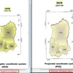
Summary: – How to Change Map Projection in QGIS, GCS to PCS.
How to Change Map Projection in QGIS
QGIS allows users to define a global and project-wide CRS (coordinate reference system) for layers without a pre-defined CRS.
It also allows the user to define custom coordinate reference systems.
Change Projection (GCS to PCS)
Change Projection (GCS to PCS) in QGIS? following the Steps below:
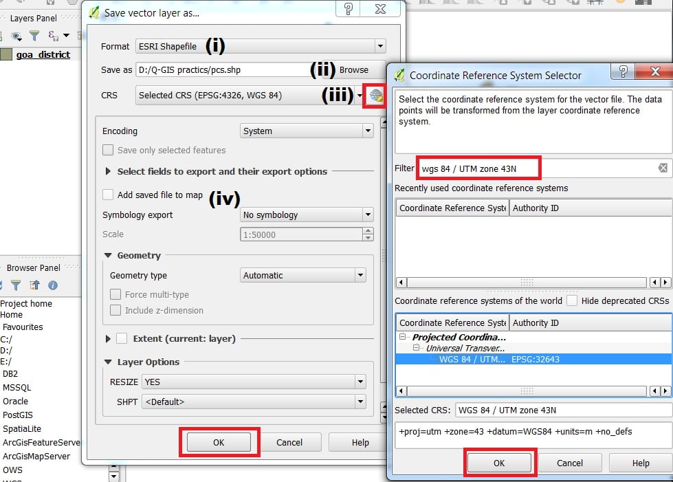
1. Select the layer from the Layers panel. Click the right button and choose the Save As option.
2. In the Save vector layer as a window, choose Format ‘ESRI Shapefile (i) > in the Save as a section.
Click the Browse button (ii) and go to your folder.
Write down the filename and click Save button > in select CRS section (iii).
Select your map or area which (eg. goa zone is- WGS 84 / UTM zone 43N) projected coordinate system (PCS) zone.

If you do not found the above-mentioned coordinate system in the CRS window, then in the filter box write down EPGS: WGS 84 / UTM zone 43N. QGIS finds the desired coordinate system and shows the bottom section of the CRS window.
3. Uncheck Add saved file to map checkbox (iv) > Click OK button to close the Save vector layer as Window.
Notice change the coordinates- Move the cursor around the map. In the Status Bar, see how the coordinates change; coordinates for the map are provided based on the position of the cursor.


