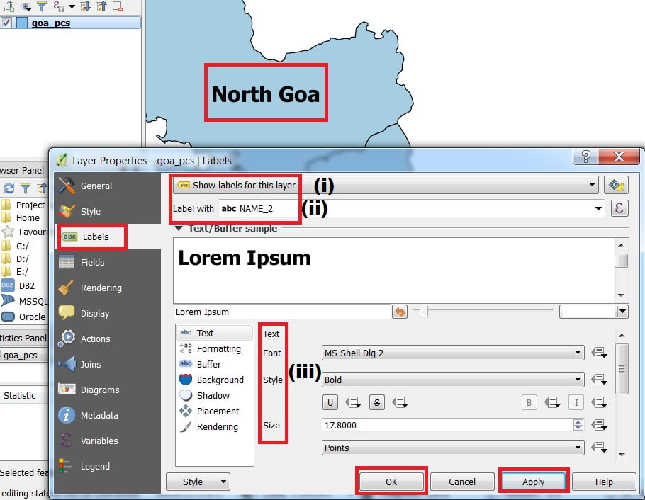
How to Add Label in QGIS
Label and Style for Vector Layer in QGIS Label Features Labeling is an easy way to add descriptive text to point, line, and polygon features on your map. Labels are dynamically placed, and label text strings are based on feature attributes. 1. Add Label Toolbar (if not already visible in your QGIS application) by going […]