Data Source Manager QGIS
In QGIS the Data Source Manager toolbar offers all the necessary layers/tools. It is a central tool in QGIS used to load and manage geospatial data from various sources. It allows users to connect to databases, open vector/raster files, web services, and more—all from one interface.
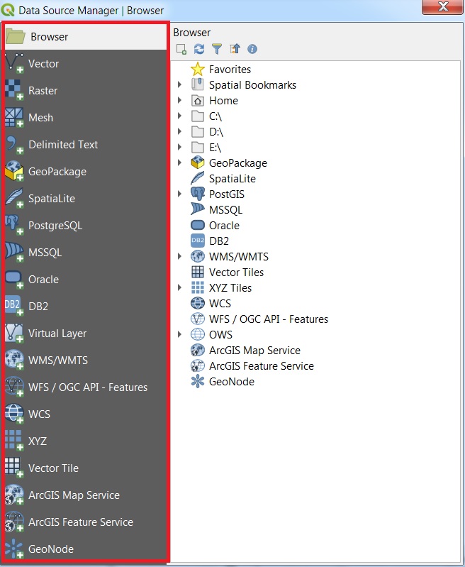
Data Source Manager toolbar provide 20 importance layers:
- Browse
- Vector
- Raster
- Mesh
- Delimited Text
- GeoPackage
- SpatiaLite
- PostgreSQL
- MSSQL
- Oracle
- DB2
- Virtual Layer
- WMS/WMTS
- WFS / OGC API – Features
- WCS
- XYZ
- Vector Tile
- ArcGIS Map Service
- ArcGIS Feature Service
- GeoNode
How to Open Data Source Manager
Two ways you can open Data Source Manager in QGIS;
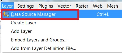
- First method to open Data Source Manager, in the Toolbar menu, click on Layer, select Data Source Manager.
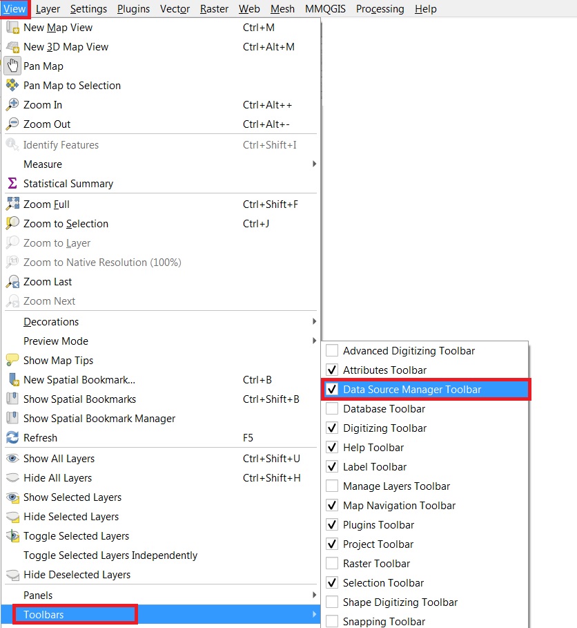
- Second method, in the Toolbar menu, click on View, hover Toolbars, and click Data Source Manager Toolbar checkbox.
Now the Data Source Manager toolbar is open.
Common Use Cases
| Task | Tool |
|---|---|
| Load shapefile | *Vector > Browse > .shp |
| Connect to PostGIS | PostgreSQL > New connection |
| Add satellite imagery | XYZ Tiles > Add OpenStreetMap/Google |
| Use CSV with coordinates | Delimited Text > Select file > Define X/Y |
| Display web maps | WMS/WMTS > Add service URL |