ArcGIS

ArcGIS Developed by ESRI,  use for mapping and analytics platform.

ArcMap Provides GIS and Mapping Products- ArcGIS Online, ArcGIS Pro, ArcGIS Enterprise, ArcGIS for Developers.

In below list of ArcGIS Tutorial.

ArcGIS data reviewer

ArcGIS Data Reviewer

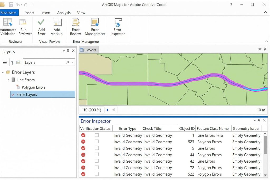
Data Reviewer ArcGIS What is Data Reviewer? Data Reviewer is an efficient and consistent data review process, that provides a comprehensive set of quality control tools. This tools support both automated and semi-automated analysis of data to detect errors. What is ArcGIS Data Reviewer? ArcGIS Data Reviewer enables management of data in support of data […]

ArcGIS Data Reviewer Read More »

ArcReader

ArcReader

ArcReader What is ArcReader? ArcReader is a free, ArcGIS application developed by Esri that allows users to view high-quality interactive maps created using ArcGIS Desktop with the Publisher extension., specifically those saved in the Published Map File (.PMF) format. ArcReader provides all the GIS users to share maps locally, over networks, and also on the

ArcReader Read More »

ArcGIS Publisher

ArcGIS Publisher

ArcGIS Publisher Tutorial What is ArcGIS Publisher? ArcGIS Publisher offers you to easily share digital versions of maps and data through ArcMap or ArcGlobe and ArcGIS Pro. It’s helps you to convert ArcGIS Pro maps to mobile map packages viewable with the free ArcGIS Explorer app for Android and iOS. Features Publisher Extension Publisher is

ArcGIS Publisher Read More »

ArcGIS For Student Use

ArcGIS For Student Use

ArcGIS For Student Use Introduction ArcGIS for Student use comes with everything you need to learn skills that will set you apart to your professors and to future employers. Get access to the full range of ArcGIS capabilities to create rich, dynamic maps and apps. ArcGIS for Student Price The ArcGIS for Students delivers an

ArcGIS For Student Use Read More »

ArcGIS LocateXT

ArcGIS LocateXT What is LocateXT? ArcGIS LocateXT is a software for analysis of unstructured data, helping organizations that are burdened with reading, organizing, and contextualizing massive amounts of data. The LocateXT sense making capability automatically searches large volumes of unstructured data included in documents, PDFs, spreadsheets, and more. Benefits of LocateXT LocateXT Extract Locations In

ArcGIS LocateXT Read More »

Scroll to Top