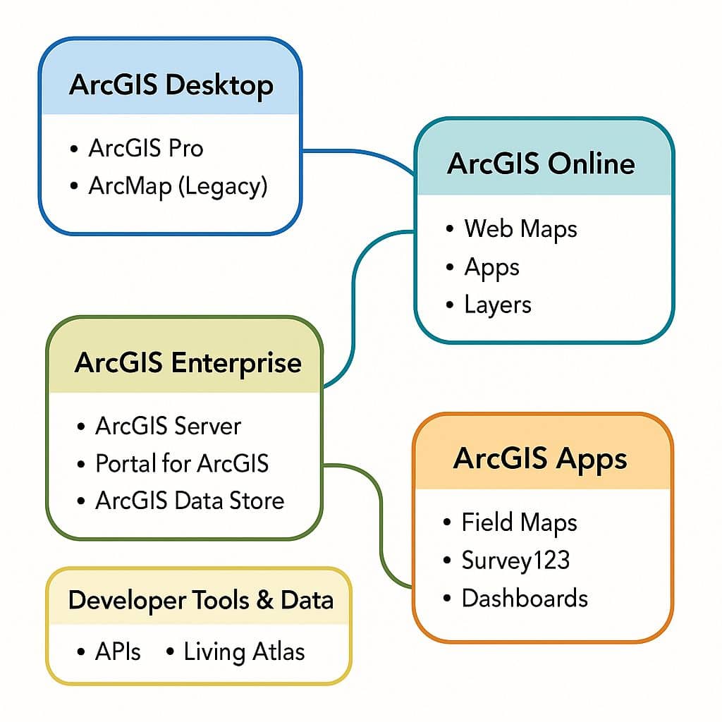
ArcGIS

ArcGIS Developed by ESRI,  use for mapping and analytics platform.

ArcMap Provides GIS and Mapping Products- ArcGIS Online, ArcGIS Pro, ArcGIS Enterprise, ArcGIS for Developers.

In below list of ArcGIS Tutorial.

arcgis developer workflow

ArcGIS Developer

Introduction ArcGIS Developer access to APIs, location services, and tools to develop your own mapping and spatial analysis applications. Use mapping products for developers to build web, native, offline, desktop, or integrated solutions for yourself, your organizations. Access a full suite of location services to provide Basemap layers, Geocoding and routing capabilities, and other Geospatial […]

ArcGIS Developer Read More »

ArcGIS components

ArcGIS Software

ArcGIS was first released in 1999 and originally was released as ArcINFO. The ArcINFO was later merged into ArcGIS Desktop. After 15 years, Arc-GIS released ArcGIS Pro in 2015. ArcGIS Pro works in 2D and 3D for Cartography and Visualization and also works for Artificial Intelligence. What is ArcGIS? ArcGIS is a powerful Geographic Information

ArcGIS Software Read More »

ArcGIS Earth

ArcGIS Earth – ArcGlobe What is ArcGIS Earth? The ArcGIS Earth is a free and easy-to-use application, to visualize, and evaluate events, using 3D data on the Globe. It’s Provided 3D models, Edit KML, and Share maps. Features: Benefits: Add map layers from files and ArcGIS Living Atlas of the World, then pan, zoom, and

ArcGIS Earth Read More »

ArcMap

ArcMap: Core Component of ArcGIS Desktop What is ArcMap? ArcMap is a primary desktop applications for GIS professional. It is a central application used in ArcGIS Desktop, from Esri. It is primarily used for creating, analyzing, editing, and visualizing spatial data. Core Features and Functions A Quick Tour of ArcMap How to use ArcMap Software

ArcMap Read More »

ArcGIS Online

ArcGIS Online Tutorial In this Tutorial learn, how to use ArcGIS Online for free. Functions of ArcGIS Online: ArcGIS Online ESRI ArcGIS Online is a Cloud-based software to create and share interactive web maps. It is ESRI web-based mapping software. After login into the ArcGIS online web portal, many real time data and Tutorials is

ArcGIS Online Read More »

Scroll to Top