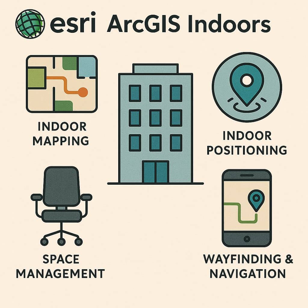
GISRSStudy » ArcGIS » Page 21

ArcGIS

ArcGIS Developed by ESRI,  use for mapping and analytics platform.

ArcMap Provides GIS and Mapping Products- ArcGIS Online, ArcGIS Pro, ArcGIS Enterprise, ArcGIS for Developers.

In below list of ArcGIS Tutorial.

ArcGIS Dissolve

Dissolve in ArcGIS Dissolve creates the regions by removing the boundaries between counties. It can be create very large features in the output Feature class. Usage Dissolve Tool in ArcGIS In ArcGIS Use the Dissolve tool when you want to aggregate features based on a specified attribute or attributes. For example, you could take a […]

ArcGIS Dissolve Read More »

ArcGIS GeoBIM

ArcGIS GeoBIM What is ArcGIS GeoBIM? ArcGIS GeoBIM (Geographic Building Information Modeling) easy-to-use web-based application to explore geospatial context for building information model, of digital transformation in the architecture, engineering, and construction (AEC) industry. Geographic information system (GIS) and Building Information Modeling (BIM) integration isn’t new in the AEC industry. ArcGIS GeoBIM is Released for

ArcGIS GeoBIM Read More »

Tracking Analyst ArcGIS

ArcGIS Tracking Analyst Introduction The ArcGIS Tracking Analyst extension is designed for mapping objects that move or change status through time. Enable Tracking Analyst Extension Before you use ArcGIS Tracking Analyst, you need to enable the extension for use with ArcGIS Desktop applications. The following procedure shows you how to enable the extension in ArcMap,

Tracking Analyst ArcGIS Read More »

Business Analyst ArcGIS

ArcGIS Business Analyst Introduction ArcGIS Business Analyst primarily helps you make smarter and data-driven decision, whether those are related to evaluating any locations, site locations or understanding your customers, or population in an area or analyzing marker as a whole. ArcGIS Business Analyst helps organizations make smarter market planning, site selection, customer segmentation, and territory

Business Analyst ArcGIS Read More »

Basemap ArcGIS

ArcGIS Basemap What is Basemap? A Basemap provides a background of geographical context for the content you want to display on a map. A basemap is used for locational reference and provides a framework on which users overlay or mash up their operational layers, perform tasks, and visualize Geographic information. Basemap layers are a kind

Basemap ArcGIS Read More »

Scroll to Top