ArcGIS

ArcGIS Developed by ESRI,  use for mapping and analytics platform.

ArcMap Provides GIS and Mapping Products- ArcGIS Online, ArcGIS Pro, ArcGIS Enterprise, ArcGIS for Developers.

In below list of ArcGIS Tutorial.

ArcGIS Open Data

ArcGIS Open Data

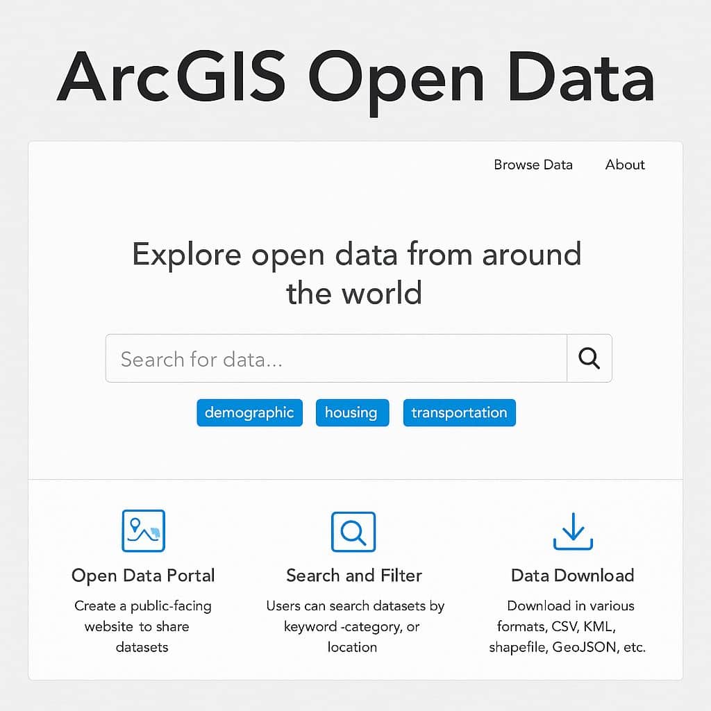
ArcGIS Open Data: Download Data From ESRI Open Data Hub Introduction ArcGIS Open Data is a free capability of ArcGIS Hub that allows governments, organizations, and communities to share authoritative geospatial data with the public via customizable websites. The Open Data enables all types of GIS data formats, its Vector and Raster data. Open data […]

ArcGIS Open Data Read More »

ArcGIS Drone2Map

ArcGIS Drone2Map

Introduction ArcGIS Drone2Map is the desktop application for Geographic Information System (GIS) drone mapping. It is capturing high-resolution imagery where and when need it. Drone2Map provides easy access to a range of tools and capabilities for accurate mapping and geospatial analysis. It’s create the 2D and 3D Photogrammetry app, including orthomosaic, 3D point clouds, and

ArcGIS Drone2Map Read More »

ArcMap Layers

Layers in ArcMap What is ArcGIS Layer? Layer is a dataset to specifies, how that dataset is portrayed using symbols and text labels. Layers are used to display geographic datasets in ArcMap, ArcGlobe, and ArcScene. When you add a layer to a map, you specify its dataset and set its map symbols and labeling properties.

ArcMap Layers Read More »

ArcGIS Intersect

Intersect in ArcGIS Computes a geometric intersection of the input features. Features or portions of features which overlap in all layers and/or feature classes will be written to the output Feature class. Usage Intersect Tool in ArcGIS A list of the input feature classes or layers. When the distance between features is less than the

ArcGIS Intersect Read More »

ArcGIS Union

Union in ArcGIS Computes a geometric union of the input features. All features and their attributes will be written to the output Feature class. Usage Union Tool in ArcGIS Union can run with a single input feature class or layer. In this case, instead of discovering overlap between the polygon features from the different feature

ArcGIS Union Read More »

Scroll to Top