ArcGIS

ArcGIS Developed by ESRI,  use for mapping and analytics platform.

ArcMap Provides GIS and Mapping Products- ArcGIS Online, ArcGIS Pro, ArcGIS Enterprise, ArcGIS for Developers.

In below list of ArcGIS Tutorial.

site scan for ArcGIS

Site Scan for ArcGIS

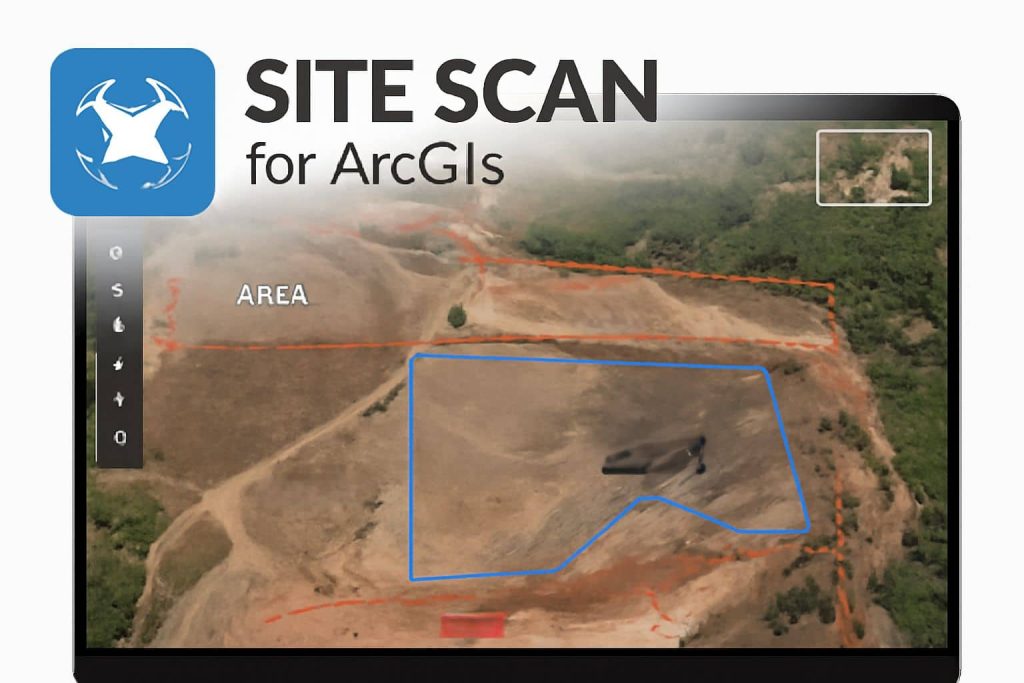
Site Scan for ArcGIS What is ArcGIS Site Scan? Site Scan for ArcGIS is the end-to-end cloud-based drone mapping software. It is designed to revolutionize imagery data collection, processing, and analysis. Its also offers to directly publish your drone data to your ArcGIS organization to perform advanced drone analytics, such as object detection and application […]

Site Scan for ArcGIS Read More »

ArcGIS Map Viewer

ArcGIS Map Viewer

ArcGIS Online Map Viewer Tutorial Use ArcGIS Online New Map Viewer to view, explore, and create web maps and navigate the map to view various areas. Also, that allows users to create, visualize, analyze, and share interactive web maps. It is designed for both beginners and advanced GIS users. You should see the messaging by

ArcGIS Map Viewer Read More »

ArcGIS Excel/ Office

ArcGIS for Excel

ArcGIS Excel / Office Introduction ArcGIS for Office is now ArcGIS for Excel. Make maps in Microsoft Excel and further the power of ArcGIS Online and ArcGIS Enterprise. It performs to transform your graphs and charts into interactive maps directly in Microsoft Excel to see data from another perspective then, easily share your map across

ArcGIS for Excel Read More »

ArcGIS Raster Calculator

Raster Calculator ArcGIS In This Tutorial we will discuss, How to use Raster Calculator in ArcGIS. The Raster Calculator executes a single Map Algebra expression, using Python syntax in a calculator-like interface. Raster Calculator Tool The Raster Calculator tool allows you to create and execute a Map Algebra expression that will output a raster. It

ArcGIS Raster Calculator Read More »

ArcGIS Density Map

Density Analysis in ArcGIS What is Density Map? The Density map is a type of Thematic map that discuss about large numbers geographic distribution like population, drainage, transportation, crime, and more. Density Analysis represents across the landscape based on the quantity that is measured at each location and the spatial relationship of the locations of

ArcGIS Density Map Read More »

Scroll to Top