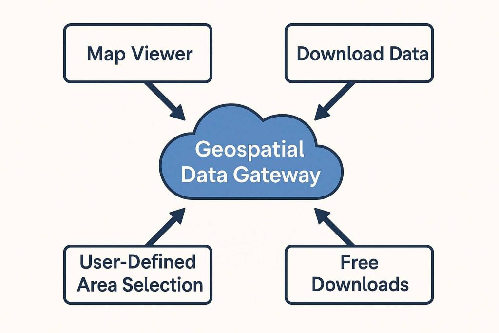
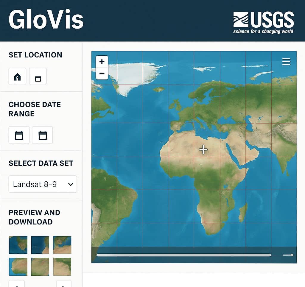
GIS Data

GIS integrates many different kinds of data layers using spatial location. Most data has a geographic component. GIS data includes imagery, features, and basemaps linked to spreadsheets and tables.

Open GIS Data

Open GIS Data GIS Open Data is a type of open source Geographic information data, that you can freely download. Many sources are available to download open source data. You can access or download cultural, Natural Earth (Raster & Vector) Country data. Open data capabilities come included in ArcGIS Online, no additional purchases or training […]

Open GIS Data Read More »

geospatial data gateway

Geospatial Data Gateway

Geospatial Database What is Geospatial Data? Geospatial data is information that has a geographic aspect to it. This type of information contains things such as an address with a city, state, and zip code. Geo-spatial data, also called spatial data, is data that correlates to a geographic location and contains a geographic components. It also

Geospatial Data Gateway Read More »

GloVis USGS

GloVis USGS

USGS Global Visualization Viewer (GloVis): Download Remote Sensing Data GloVis (Global Visualization Viewer) is a web-based tool from USGS (United States Geological Survey) for browsing and downloading satellite imagery, especially from the Landsat, ASTER, and MODIS programs. In this tutorial, you’ll assume the role of an urban planner looking for Satellite imagery of Singapore. Using

GloVis USGS Read More »

GIS Data Download

Download GIS Data Download the GIS Data from Authority websites. It has been Raster as well as Vector data. So you can Download free GIS Data and use to your project. In Below list of best GIS Data Sources sites. List of GIS Data Download Sources Global Data Source ArcGIS Hub ArcGIS Hub Provided Different

GIS Data Download Read More »

ArcGIS Attribute Table

Attribute Table in ArcGIS In ArcGIS Database (dBASE ) Table represent the Data table or Attribute table. Dataset in ArcGIS insights based on the type of data in the field. When you create Feature classes or tables, you select a data type for each field. Fields are the components that provide structure for a table.

ArcGIS Attribute Table Read More »

Scroll to Top