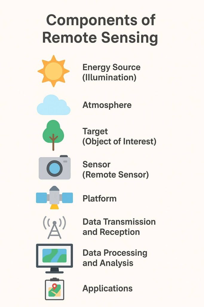
Remote Sensing Bands
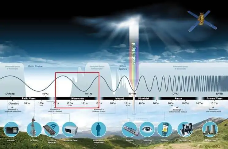
Band Combination in Remote Sensing What is a Band in Remote Sensing? In Remote Sensing the bands is a set of data file values for a specific portion of the Electromagnetic spectrum of effected light or emitted heat. There are several bands including; red, green, blue, near-infrared, thermal infrared, and so far. The bands of […]