Electromagnetic Spectrum
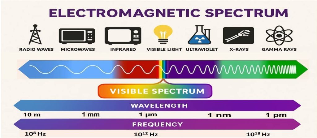
Summary: –The Electromagnetic spectrum is the complete range of electromagnetic waves arranged by their frequency and wavelength. It includes, in order from longest wavelength to shortest: radio waves, microwaves, infrared, visible light, ultraviolet, X-rays, and gamma rays. Each type of wave has unique characteristics and uses. Electromagnetic Spectrum (EMS) Unveiling the Invisible: The world of […]