Light Detection and Ranging
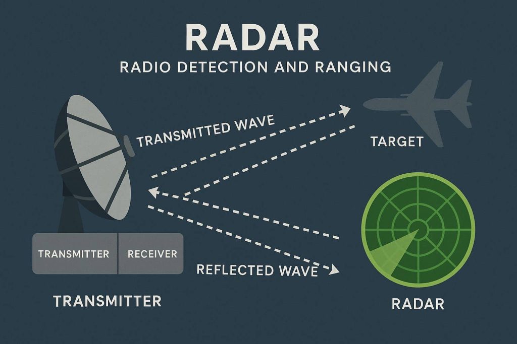
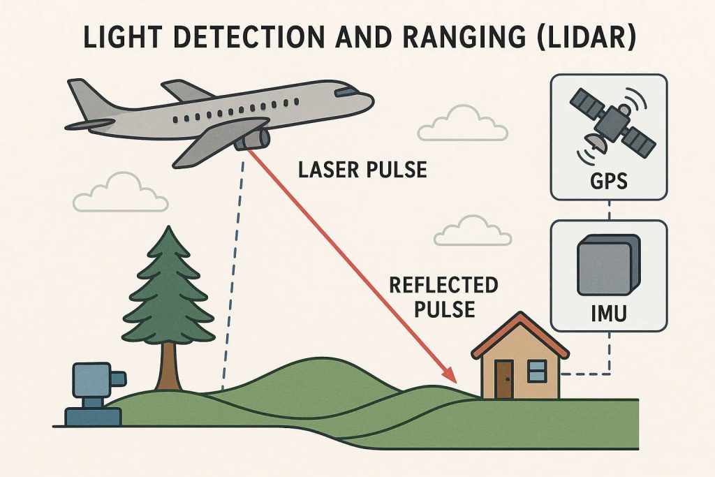
LiDAR– Light Detection and Ranging Introduction Light Detection And Ranging (LiDAR) is a remote sensing method used to examine the surface of the Earth. It uses eye-safe laser beams to see the world in 3D, providing machines and computers an accurate representation of the surveyed environment. Lidar is an optical means of measuring reflected light […]