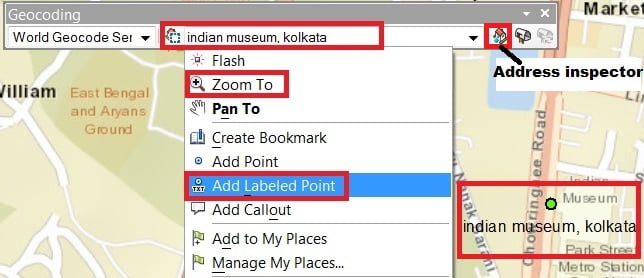
Network Analysis in GIS
Network Analysis in GIS What is Network Analysis? Network analysis solving network problems such as traversability, rate of flow, or capacity, using network connectivity. Network Analysis in GIS In GIS a Network Analysis is a system of interconnected elements, such as edges (lines) and connecting junctions (points), that represent possible routes from one location to […]