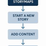
ArcGIS Tools, Toolsets
In this Tutorial discuss about Tools in ArcGIS, and how to use.
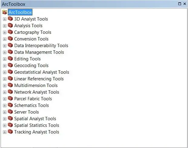
Toolsets & Tools in ArcGIS
| Toolset | |||||||||||||||||||||||||||||
|---|---|---|---|---|---|---|---|---|---|---|---|---|---|---|---|---|---|---|---|---|---|---|---|---|---|---|---|---|---|
3D Features
| |||||||||||||||||||||||||||||
CityEngine
| |||||||||||||||||||||||||||||
ConversionFrom Feature Class
From File
From LAS Dataset
From Raster
From Terrain
From TIN
| |||||||||||||||||||||||||||||
Data ManagementLAS Dataset
Terrain Dataset
TIN
| |||||||||||||||||||||||||||||
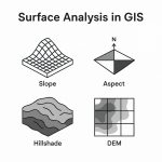
Functional Surface
| |||||||||||||||||||||||||||||
Raster Interpolation
| |||||||||||||||||||||||||||||
Raster Math
| |||||||||||||||||||||||||||||
Raster Reclass
| |||||||||||||||||||||||||||||
Raster Surface
| |||||||||||||||||||||||||||||
Triangulated Surface
| |||||||||||||||||||||||||||||
Visibility
|
| Toolsets | ||||||||
|---|---|---|---|---|---|---|---|---|
Extract
| ||||||||
Overlay
| ||||||||
Proximity
| ||||||||
Statistics
|
Annotation
| ||||||||||||||
Cartographic Refinement
| ||||||||||||||
Data Driven Pages
| ||||||||||||||
Generalization | ||||||||||||||
Graphic Conflicts
| ||||||||||||||
Grids and Graticules
| ||||||||||||||
Masking Tools
| ||||||||||||||
Representation Management
|
| Toolset | ||||||||||||||
|---|---|---|---|---|---|---|---|---|---|---|---|---|---|---|
Excel
| ||||||||||||||
From GPS
| ||||||||||||||
From KML
| ||||||||||||||
From PDF
| ||||||||||||||
From Raster
| ||||||||||||||
From WFS
| ||||||||||||||
JSON
| ||||||||||||||
Metadata
| ||||||||||||||
To CAD
| ||||||||||||||
To Collada
| ||||||||||||||
To Coverage
| ||||||||||||||
To dBASE
| ||||||||||||||
To Geodatabase
| ||||||||||||||
To KML
| ||||||||||||||
To Raster
| ||||||||||||||
To Shapefile
|
Data Interoperability
| Tool |
|---|
| Tool |
|---|
Conflation
| Tools |
|---|
| Tool |
|---|
Interpolation
| |||||||||
Sampling Network Design
| |||||||||
Simulation
| |||||||||
Utilities
| |||||||||
Working with Geostatistical Layers
|
| Tool |
|---|
| Tool |
|---|
| Toolsets | ||||||||||||||
|---|---|---|---|---|---|---|---|---|---|---|---|---|---|---|
Analysis
| ||||||||||||||
Network Dataset
| ||||||||||||||
Server
| ||||||||||||||
Turn Feature Class
|
| Toolset | |||
|---|---|---|---|
Data Migration
| |||
Layers And Table Views
| |||
Parcel Features
|
| Tool |
|---|
| Toolset | |||||||||||||
|---|---|---|---|---|---|---|---|---|---|---|---|---|---|
Caching
| |||||||||||||
Data Extraction
| |||||||||||||
Printing
| |||||||||||||
Publishing
|
| Toolset | ||||||||||||||||||||||||||||||||||||||||||||||||||||||||||||||
|---|---|---|---|---|---|---|---|---|---|---|---|---|---|---|---|---|---|---|---|---|---|---|---|---|---|---|---|---|---|---|---|---|---|---|---|---|---|---|---|---|---|---|---|---|---|---|---|---|---|---|---|---|---|---|---|---|---|---|---|---|---|---|
Conditional
| ||||||||||||||||||||||||||||||||||||||||||||||||||||||||||||||
Density
| ||||||||||||||||||||||||||||||||||||||||||||||||||||||||||||||
Distance
| ||||||||||||||||||||||||||||||||||||||||||||||||||||||||||||||
Extraction
| ||||||||||||||||||||||||||||||||||||||||||||||||||||||||||||||
Generalization
| ||||||||||||||||||||||||||||||||||||||||||||||||||||||||||||||
Groundwater
| ||||||||||||||||||||||||||||||||||||||||||||||||||||||||||||||
Hydrology
| ||||||||||||||||||||||||||||||||||||||||||||||||||||||||||||||
Interpolation
| ||||||||||||||||||||||||||||||||||||||||||||||||||||||||||||||
Local
| ||||||||||||||||||||||||||||||||||||||||||||||||||||||||||||||
Map Algebra
| ||||||||||||||||||||||||||||||||||||||||||||||||||||||||||||||
Math
| ||||||||||||||||||||||||||||||||||||||||||||||||||||||||||||||
Multivariate
| ||||||||||||||||||||||||||||||||||||||||||||||||||||||||||||||
Neighborhood
| ||||||||||||||||||||||||||||||||||||||||||||||||||||||||||||||
Overlay
| ||||||||||||||||||||||||||||||||||||||||||||||||||||||||||||||
Raster Creation
| ||||||||||||||||||||||||||||||||||||||||||||||||||||||||||||||
Reclass
| ||||||||||||||||||||||||||||||||||||||||||||||||||||||||||||||
Solar Radiation
| ||||||||||||||||||||||||||||||||||||||||||||||||||||||||||||||
Segmentation and Classification
| ||||||||||||||||||||||||||||||||||||||||||||||||||||||||||||||
Surface
| ||||||||||||||||||||||||||||||||||||||||||||||||||||||||||||||
Zonal
|
| Toolset | |||||||
|---|---|---|---|---|---|---|---|
Analyzing Patterns
| |||||||
Mapping Clusters
| |||||||
Measuring Geographic Distributions
| |||||||
Modeling Spatial Relationships
| |||||||
Rendering
| |||||||
Utilities
|
| Tool |
|---|