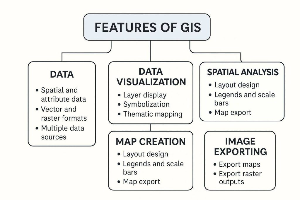
Features of GIS
A Geographic Information System (GIS) is a framework for gathering, managing, analyzing, and visualizing spatial or geographic data. It combines location data (where things are) with descriptive data (what things are) to support decision-making across a wide range of fields.
5 most Importance GIS Features are:
- Data
- Data Visualizations
- Map Creation
- Spatial Analysis
- Image Exporting
Data
Data is the most importance part of GIS feature. Everything’s based on the Data for any creation on Analysis.
- Supports spatial data (coordinates, geometry) and attribute data (descriptive information).
- Handles vector (points, lines, polygons) and raster (images, elevation).
- Compatible with multiple data formats: Shapefile, GeoTIFF, KML, CSV, GPKG, etc.
- Integrates with databases (e.g., PostgreSQL/PostGIS, SQLite, Oracle Spatial).
Data Visualizations
Identify and visualize Data structure and use GIS Software.
- Display and style multiple layers with symbolization and color ramps.
- Thematic mapping (e.g., choropleths, graduated symbols).
- Dynamic legends and labeling based on attributes.
- Real-time data overlays (e.g., live traffic, weather).
Map Creation
Visualize the Data, then create a map.
- Design and layout tools for map composition.
- Add legends, north arrows, scale bars, and titles.
- Print-ready or digital maps for reports and presentations.
- Coordinate grid and inset maps support.
Spatial Analysis
Spatial Analysis is one of the most important features in GIS.
- Proximity: buffers, nearest neighbor.
- Overlay: intersect, union, difference.
- Surface: slope, aspect, hillshade from elevation data.
- Interpolation: IDW, Kriging, Spline, Natural Neighbor.
- Network analysis: routing, service areas.
Image Exporting
Complete of the process in GIS, now export created image.
- Export maps as high-resolution images: PNG, JPEG, PDF, SVG.
- Export raster outputs (e.g., elevation, land cover) as GeoTIFF or other raster formats.
- Share via web maps or interactive platforms (ArcGIS Online, QGIS Cloud).
- Batch export or scripted export using Python or model tools.