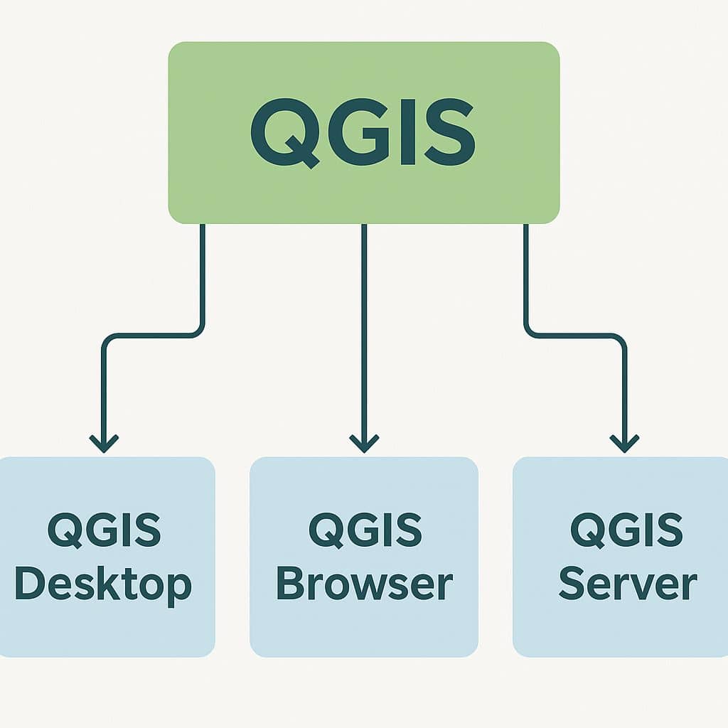
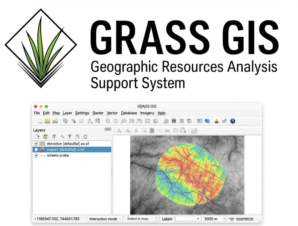
GIS Software

A GIS software is a computer program to support the use of a geographic information system, providing the ability to create, store, manage, query, analyze, and visualize geographic data. For ex.- ArcGIS, QGIS, GRASS, SAGA, ILWIS, etc.

QGIS 3.0

QGIS 3.0 Tutorial QGIS to QGIS 3.0 is a revolutionary change in OSGeo4W. Download QGIS 3 Download the QGIS current version is 3.34.0 ‘Prizren’ released on 27.10.2023. What’s new in QGIS 3.0 Version This release has the following new features: General Expressions User Interface Symbology Digitizing Data Management Forms and Widgets Map Composer Processing Data […]

QGIS 3.0 Read More »

GIS Softwares

Best GIS Software’s In this lesson, we will discuss the best GIS Softwares for mapping. List of Top 10 GIS Softwares ArcGIS Pro ArcGIS Pro, the powerful, modern Professional desktop GIS application from ESRI, ArcGIS Pro offers 2D, 3D, and 4D data analytics. Study ArcGIS Pro Tutorial. ArcGIS Desktop ArcGIS Developed by ESRI, this is

GIS Softwares Read More »

What Is QGIS

QGIS What is QGIS? QGIS stand for Quantum GIS, it’s a Free and open-source GIS Software to perform GIS (Geographic Information System) application, that supports create, edit, visualize and analysis of Geo-spatial data. Download QGIS Software The current version is 3.34.0 ‘Prizren’ has been released. Download QGIS Software. Q-GIS is available on Windows, macOS, Linux

What Is QGIS Read More »

ArcGIS

ArcGIS What is ArcGIS? ArcGIS is a powerful GIS (Geographic Information System) Application for Mapping and manipulating Data. It is developed and maintained by ESRI. It’s offers location based analytics to your Studies or Business practices. Gain greater insights using contextual tools to visualize and analyze your data. Collaborate and share via maps, apps, dashboards

ArcGIS Read More »

Learn ArcGIS Software

Learn ArcGIS Software This Tutorial we will discuss what is ArcGIS Software, and to How use? First, Download ArcGIS Software, and Install this in your system. The installation process is complete, with 4 different features available in your system. ArcCatalog- use for managing the spatial data holdings and database designs, and for recording and viewing

Learn ArcGIS Software Read More »

Scroll to Top