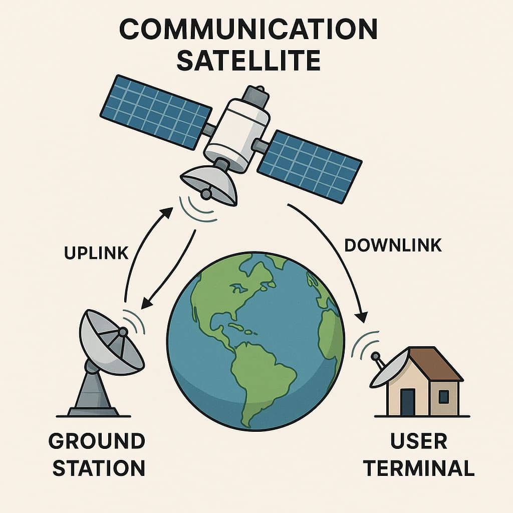
Remote Sensing

Remote sensing (RS) is an art and science of obtaining information about physical characteristics of an area by measuring its reflected and emitted radiation at a distance to help of Satellite or Aircraft.

In below list of Remote sensing Analysis Tutorial.

navigation satellite system

Navigation Satellite Systems

Navigation Satellites Satellites navigation services to meet the emerging demands of the Civil Aviation requirements and to meet the user requirements of the positioning, navigation and timing based on the independent satellite navigation systems. Satellite Navigation Systems is based on a global network of satellites that transmit radio signals from medium earth orbit. Satellite Navigation

Navigation Satellite Systems Read More »

Synthetic Aperture Radar

Summary: – Synthetic Aperture Radar (SAR) is an active remote sensing technology that uses microwave radar signals to create high-resolution images of the Earth’s surface, regardless of weather conditions or daylight. What is Synthetic Aperture Radar? A Synthetic Aperture Radar (SAR) is an airborne or spaceborne side looking Radar system which utilizes the flight path

Synthetic Aperture Radar Read More »

Scroll to Top