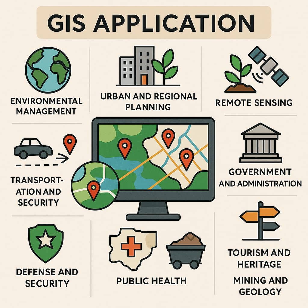
GISRSStudy » GIS » Page 17

GIS

GIS (Geographic Information System) is a framework to organize, communicate, and understand the science of our world. GIS integrates many types of data. It analyzes spatial location and organizes layers of information into visualizations using maps and 3D scenes. Every field are using GIS to make maps that communicate, perform analysis, share information, and solve complex problems around the world.

In below list of GIS Analysis Tutorial.

Metadata

Metadata in GIS & Remote Sensing What is Metadata? Metadata is basically textual data that describes data. It often includes elements such as data creation date, history of the data, data type, and common usages of the data. Digital Geographic data is an attempt to model and describe the real world for use in computer […]

Metadata Read More »

Uses for Sonar

Sonar – Sound Navigation And Ranging Sonar (Sound Navigation And Ranging) is exploring and mapping the ocean, because sound waves travel farther in the water than do Radar and light waves. The Sonar is a technique that uses sound propagation to navigate, measure ranging, communicate with or detect objects on or under the surface of

Uses for Sonar Read More »

SRTM Data

SRTM – Shuttle Radar Topography Mission On 23 September 2014, the White House announced that the highest-resolution topographic data generated from NASA‘s that is Shuttle Radar Topography Mission (SRTM), it was released globally by late 2015. The Shuttle Radar Topography Mission is elevation data on a near-global scale, acquired from the Space Shuttle, to generate

SRTM Data Read More »

Download DEM

Digital Elevation Model (DEM) Download Digital Elevation Model (DEM) widely known as a Digital Terrain Model (DTM). A DEM can be used to create topographic maps of overland terrain, as well as bathymetric maps. A DEM data can be represented as a raster dataset, or as a vector-based Triangular Irregular Network (TIN). Best 6 Free

Download DEM Read More »

Scroll to Top