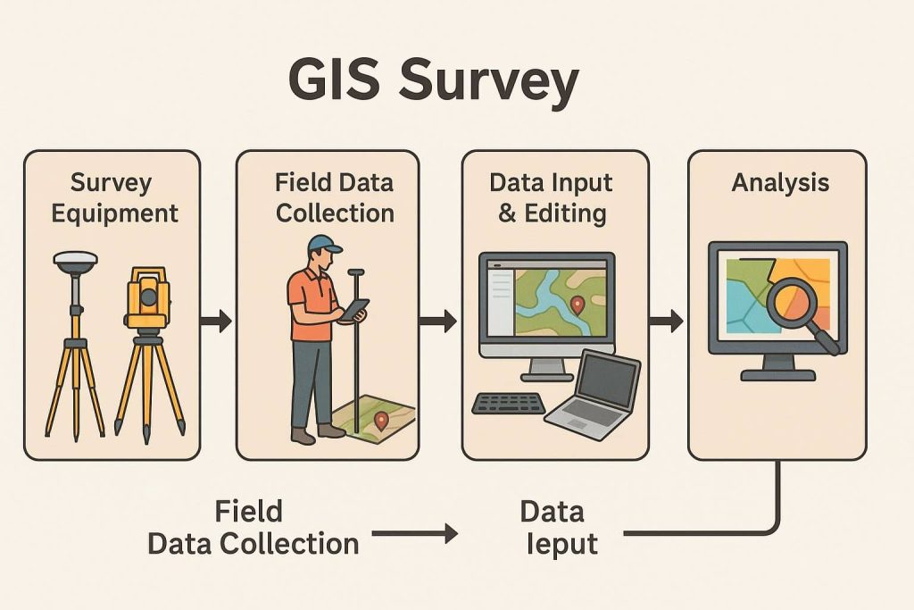
GIS

GIS (Geographic Information System) is a framework to organize, communicate, and understand the science of our world. GIS integrates many types of data. It analyzes spatial location and organizes layers of information into visualizations using maps and 3D scenes. Every field are using GIS to make maps that communicate, perform analysis, share information, and solve complex problems around the world.

In below list of GIS Analysis Tutorial.

GIS Data Download

Download GIS Data Download the GIS Data from Authority websites. It has been Raster as well as Vector data. So you can Download free GIS Data and use to your project. In Below list of best GIS Data Sources sites. List of GIS Data Download Sources Global Data Source ArcGIS Hub ArcGIS Hub Provided Different […]

GIS Data Download Read More »

GIS Survey

GIS Surveying

GIS Survey GIS Surveying is a field analysis or research to collect accurate information of any land, ocean or other features. Geospatial Survey helps you to analysis Physical phenomena in the World. It’ also allows us to find out what is happening inside a specific area or nearby to a specific area. The GIS Surveyors

GIS Surveying Read More »

GIS Data Types

GIS Data Types

Types of GIS Data GIS Data Types GIS (Geographic Information System) data can be broadly classified into three main types, each with its own subtypes: Spatial Data (Geospatial Data) There are two different types of Spatial data, I) Vector data and II) Raster data. Each type of data has its own format. Vector Data Vector

GIS Data Types Read More »

Metadata in GIS

Metadata in GIS

Metadata in GIS & Remote Sensing What is Metadata? Metadata is basically textual data that describes data. It often includes elements such as data creation date, history of the data, data type, and common usages of the data. Digital Geographic data is an attempt to model and describe the real world for use in computer

Metadata in GIS Read More »

SRTM Data

SRTM Data

SRTM- Shuttle Radar Topography Mission On 23 September 2014, the White House announced that the highest-resolution topographic data generated from NASA‘s that is Shuttle Radar Topography Mission (SRTM), it was released globally by late 2015. The Shuttle Radar Topography Mission is elevation data on a near-global scale, acquired from the Space Shuttle, to generate the

SRTM Data Read More »

Scroll to Top