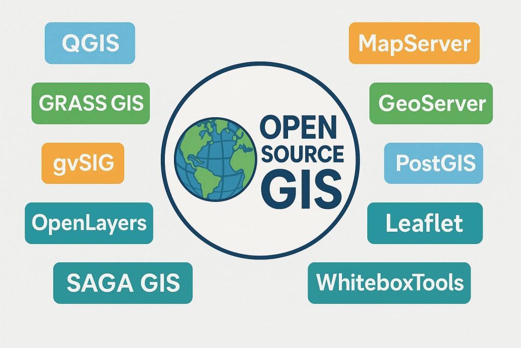
GIS Software

A GIS software is a computer program to support the use of a geographic information system, providing the ability to create, store, manage, query, analyze, and visualize geographic data. For ex.- ArcGIS, QGIS, GRASS, SAGA, ILWIS, etc.

ArcGIS components

ArcGIS Software

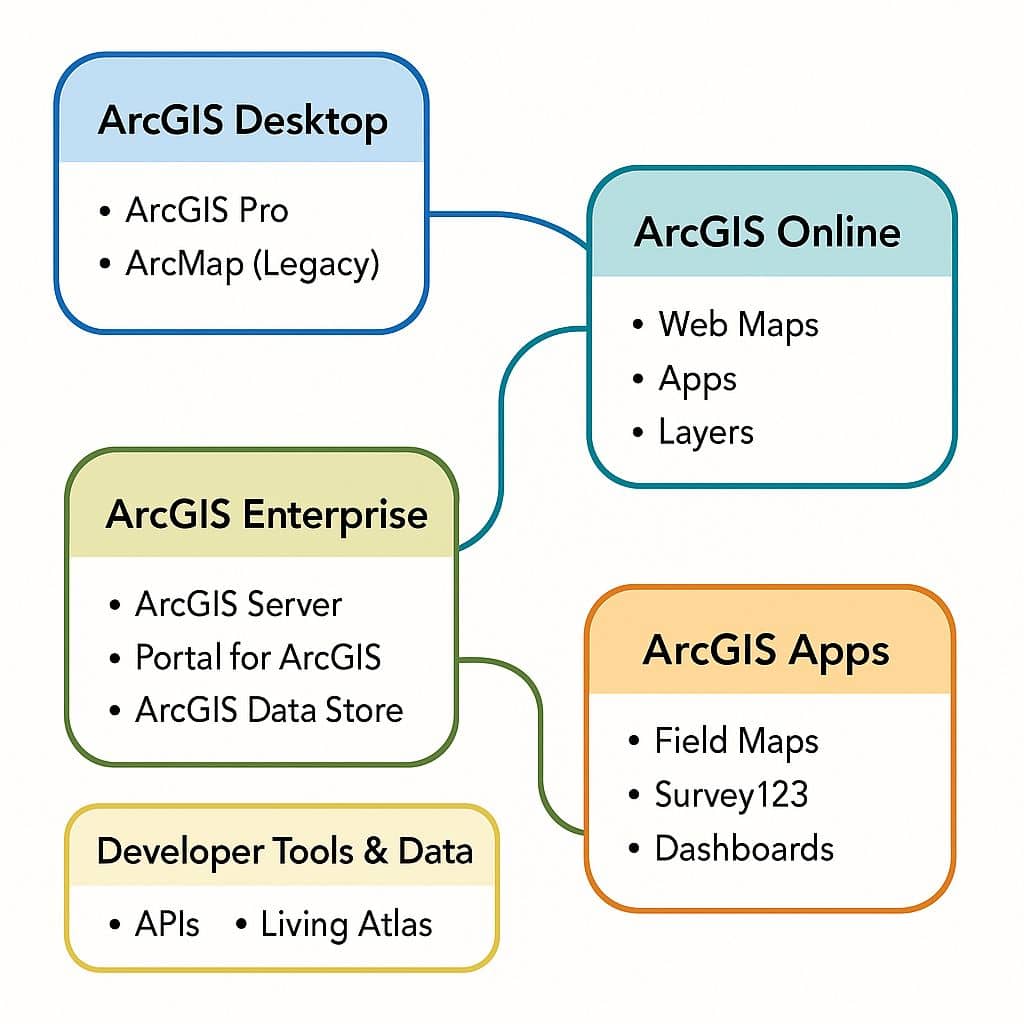
ArcGIS was first released in 1999 and originally was released as ArcINFO. The ArcINFO was later merged into ArcGIS Desktop. After 15 years, Arc-GIS released ArcGIS Pro in 2015. ArcGIS Pro works in 2D and 3D for Cartography and Visualization and also works for Artificial Intelligence. What is ArcGIS? ArcGIS is a powerful Geographic Information […]

ArcGIS Software Read More »

Open Source GIS

Free and Open-Source GIS Software Open-Source GIS refers to GIS software that is freely available for use, modification, and distribution under open licenses. It is supported by global communities of developers and users who contribute to its improvement, ensuring continuous innovation and transparency. Open-source GIS is valued for its cost effectiveness, customization capabilities, and interoperability.

Open Source GIS Read More »

Scroll to Top