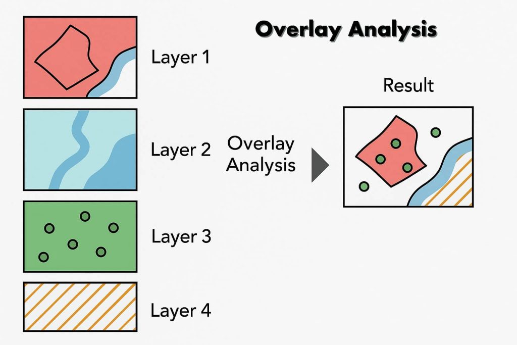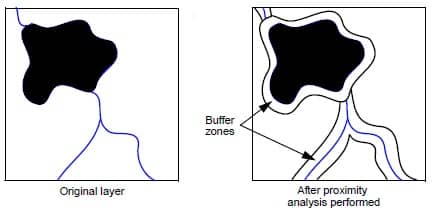
Proximity Analysis ArcGIS
Proximity Analysis What is Proximity Analysis? Proximity analysis determines which pixels of a layer are located at specified distances from pixels in a certain class or classes. A new thematic layer is created, which is categorized by the distance of each pixel from specified classes of the input layer. This new file then becomes a […]