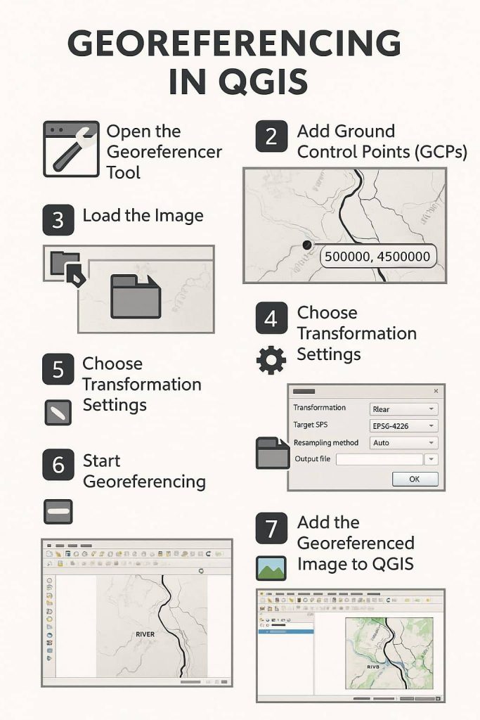
Georeferencing Online
Online Georeferencing: A Modern Approach to Accurate Map Alignment Georeferencing is a Coordinate system of a digital map to a ground system of Geographic Coordinates. A Georeferenced image has been to a known Earth Coordinate system, that is Latitude (Y) and Longitude (X). This term is commonly used in the Geographic Information System (GIS). In […]