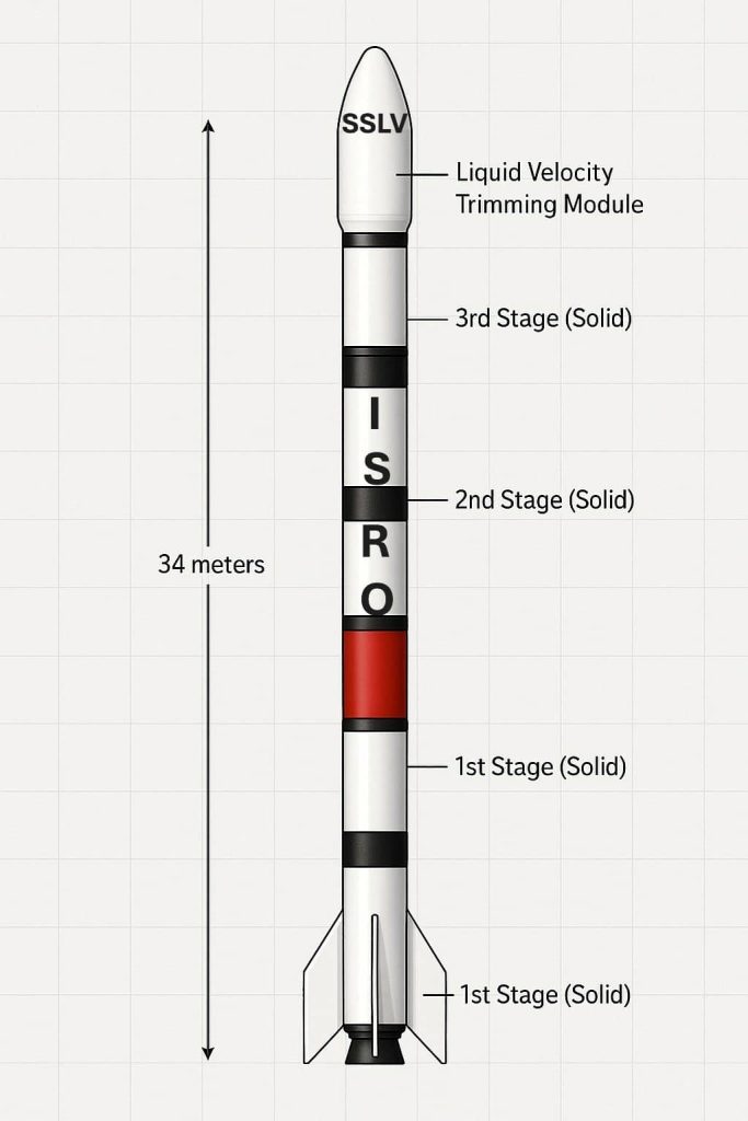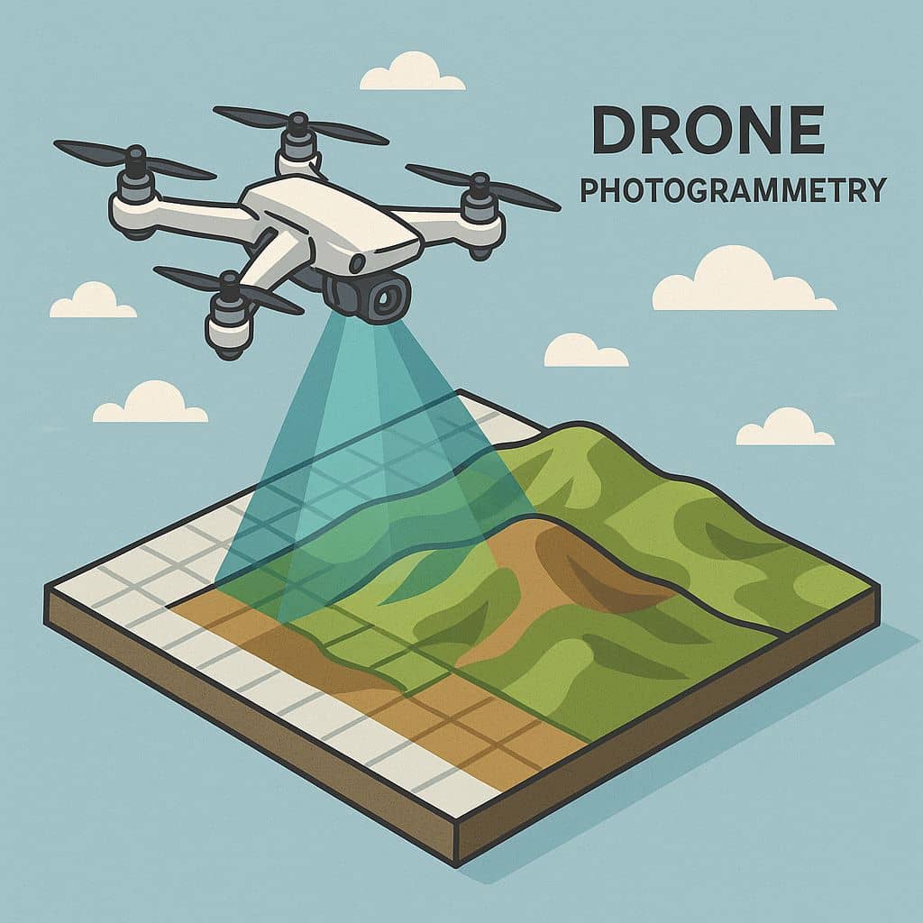
Drone Photogrammetry
An Overview of Drone-Based Photogrammetry Techniques and its Real-World Application In drone photogrammetry, a drone captures high resolution aerial images, which then can be processed by various Photogrammetry software to become accurate, detailed 3D models and 2D maps. Indroduction Drone photogrammetry is the science of using aerial images captured by drones to create detailed and […]