GIS

GIS (Geographic Information System) is a framework to organize, communicate, and understand the science of our world. GIS integrates many types of data. It analyzes spatial location and organizes layers of information into visualizations using maps and 3D scenes. Every field are using GIS to make maps that communicate, perform analysis, share information, and solve complex problems around the world.

In below list of GIS Analysis Tutorial.

mobile gis

Mobile GIS

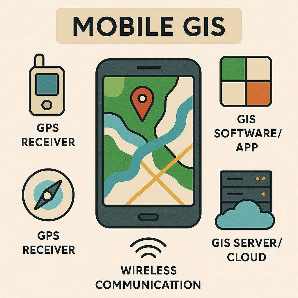
Mobile GIS Introduction Mobile GIS is the expansion of GIS technology from enables field-based personnel to capture, store, update, manipulate, analyze, and display Geographic Information. This is integrates one or more of the following technologies- Applications Components Advantages Mobile Mapping Mobile Mapping is the combination of geographic information system (GIS) software, globalpositioning systems (GPS), and […]

Mobile GIS Read More »

WebGIS

Summary: – WebGIS include real-time data access, user-friendly interfaces, interactive maps, and cloud-based data storage. It supports a wide range of applications, and Data Formats. It is built using web technologies such as HTML, JavaScript, Web Mapping Services (WMS), and APIs, and often leverages platforms like Leaflet. Introduction: Mapping Magic in the Digital Age. Have

WebGIS Read More »

Digitization in GIS

What is Digitization? Digitizing or Digitization is the process of converting geographic data into a digital format, is one way to create data. There are several ways to digitize new features in Geographic Information Systems (GIS). Digitization is a basic process in GIS that enables us to transform paper maps, and satellite images, into digital

Digitization in GIS Read More »

GIS of India

GIS in India India is a vast country, with a population of approx than 14 million people spread over 3.3 million square kilometers. The country is composed of more than 7,000 cities and 600,000 villages. ISRO (Indian Space Research Organisation) has a vibrant Indian Remote Sensing (IRS) program since 1988 with a gamut of Indian

GIS of India Read More »

Features of GIS

GIS Features

Features of GIS A Geographic Information System (GIS) is a framework for gathering, managing, analyzing, and visualizing spatial or geographic data. It combines location data (where things are) with descriptive data (what things are) to support decision-making across a wide range of fields. 5 most Importance GIS Features are: Data Data is the most importance

GIS Features Read More »

Scroll to Top