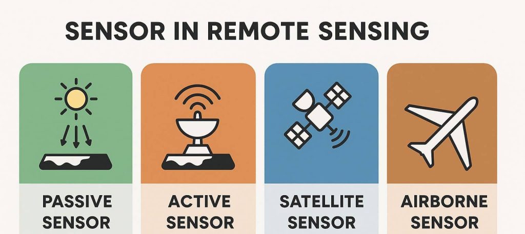
GISRSStudy » Sensor » Page 3

Sensor

A sensor is a device that produces an output signal for the purpose of sensing a physical phenomenon. In Remote Sensing, using scanning systems, which employ a Sensor with a narrow Instantaneous Field of View (IFOV) that sweeps over the terrain.

Types of Sensor

Sensor in Remote Sensing What is Sensor? A Sensor is a device that produces an output signal for the purpose of sensing a physical phenomenon. Sensors are used in everyday different objects, such as touch-sensitive elevator buttons and lamps. With advances in micro-machinery and easy-to-use micro-controller platforms, the uses of sensors have expanded beyond the […]

Types of Sensor Read More »

Uses for Sonar

Sonar – Sound Navigation And Ranging Sonar (Sound Navigation And Ranging) is exploring and mapping the ocean, because sound waves travel farther in the water than do Radar and light waves. The Sonar is a technique that uses sound propagation to navigate, measure ranging, communicate with or detect objects on or under the surface of

Uses for Sonar Read More »

Uses for Radar

Radar – Radio Detection And Ranging Radar (Radio Detection And Ranging) is a detection system that uses radio waves to determine the distance, angle, and radial velocity of objects relative to the site. The term Radar was minted in 1940 by the United States Navy as an acronym for radio detection and ranging. It was developed privately for military use by

Uses for Radar Read More »

Scroll to Top