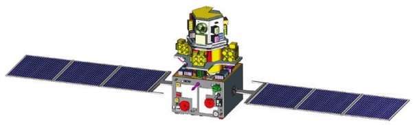
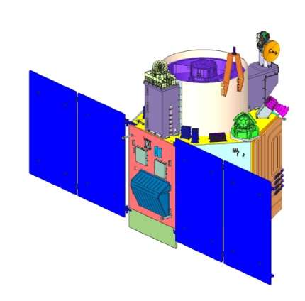
Remote Sensing

Remote sensing (RS) is an art and science of obtaining information about physical characteristics of an area by measuring its reflected and emitted radiation at a distance to help of Satellite or Aircraft.

In below list of Remote sensing Analysis Tutorial.

Cartosat Satellite sensor

Cartosat Satellite

CartoSat Satellite The Cartosat satellites is a Indian optical earth observation satellites and operated by the Indian Space Research Organisation (ISRO). They are used for Earth’s resource management, defence services and monitoring. Oceansat Satellite Specification: CartoSat Satellites Series Satellite Resolution (m) Power Launch date, Time (UTC) Launch mass Launch vehicle Launch site Cartosat-1 2.5 1100 W […]

Cartosat Satellite Read More »

Resourcesat Satellite sensor

Resourcesat Satellite

ResourceSat Satellite Resourcesat Satellite (IRS-P6) is an advanced Remote Sensing satellite built by Indian Space Research Organization (ISRO). Resourcesat Sensor Specifications: Sensor AWiFS LISS-3 Number of Bands 4 4 Spectral Band 2 (µ) 0.52 – 0.59 (green) 0.52 – 0.59 (green) Spectral Band 3 (µ) 0.62 – 0.68 (red) 0.62 – 0.68 (red) Spectral Band

Resourcesat Satellite Read More »

OceanSat Satellite sensor

Oceansat Satellite

OceanSat Satellite Oceansat (IRS-P4) satellite is a earth observation satellites, operated by Indian Space Research Organisation (ISRO). It is the first satellite primarily built for Ocean applications. This satellite carries Ocean Colour Monitor (OCM) and a Multi – frequency Scanning Microwave Radiometer (MSMR) for oceanographic studies. Oceansat Satellite Specification: Oceansat Satellites Series Designation Launch date,

Oceansat Satellite Read More »

ASTER Satellite Sensor

ASTER Satellite

ASTER Satellite Sensor ASTER stand for Advanced Spaceborne Thermal Emission and Reflection Radiometer, it is operating on the Terra spacecraft. The Terra satellite launched in December 1999 as part of NASA’s Earth Observing System (EOS), a Sun-synchronous polar orbit. ASTER is a cooperative effort between NASA, Japan’s Ministry of Economy, Trade and Industry (METI), and

ASTER Satellite Read More »

Panchromatic Imagery

Panchromatic Image

Panchromatic Sensor in Remote Sensing The Panchromatic (PAN) Sensor had 5.8 m spatial resolution, as well as stereo capability. Its swath width is 70 m. Revisit time was every five days, with ± 26° off-nadir viewing. Panchromatic Band Band Wavelenth (µm) pan 0.5 to 0.75 Key Features of Panchromatic Image Feature Description Type Single band

Panchromatic Image Read More »

Scroll to Top