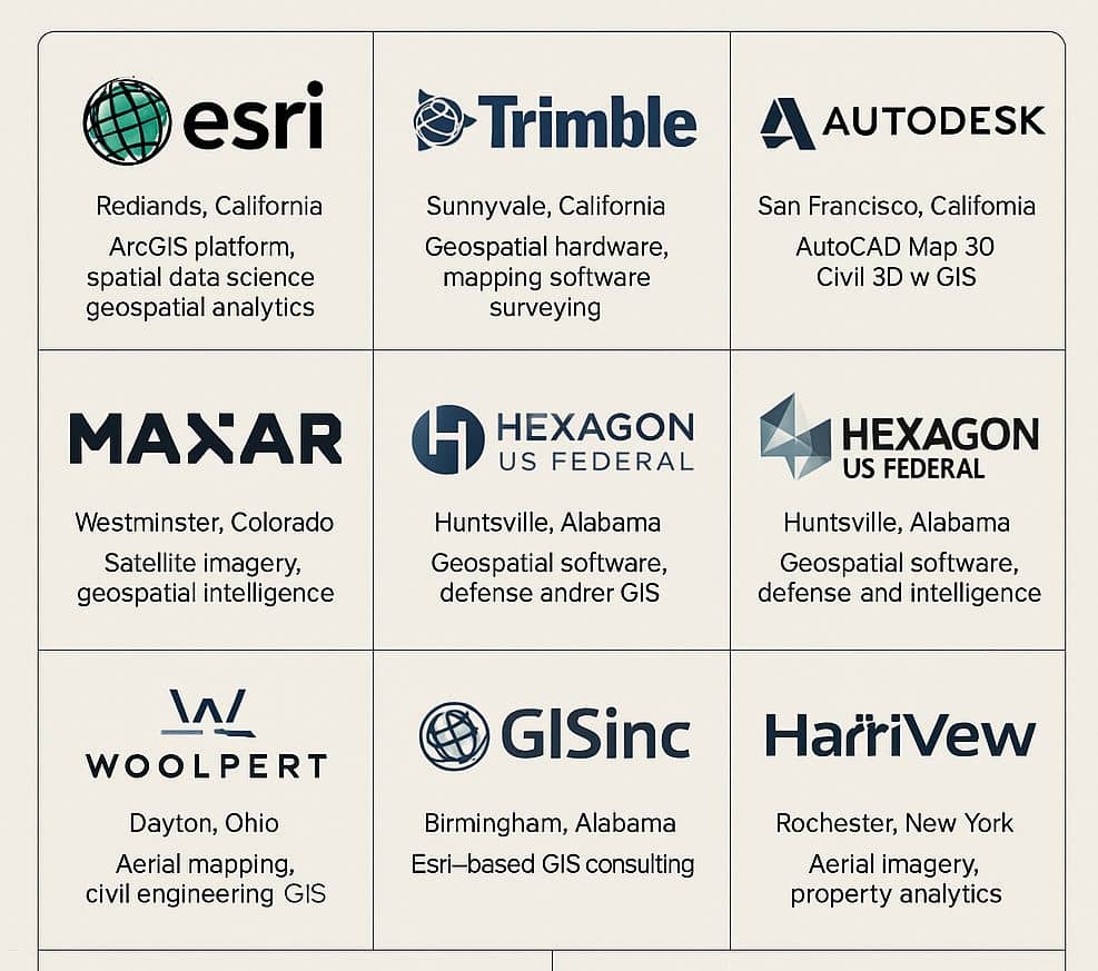
GIS Companies in USA
GIS Companies in USA Best GIS Jobs in USA Companies List of GIS Company in USA GIS Companies in California GIS Companies in Carolina GIS Companies in Colorado GIS Companies in Connecticut GIS Companies in Georgia GIS Companies in Massachusetts GIS Companies in Missouri GIS Companies in New York City GIS Companies in Ohio GIS […]