Sensor

A sensor is a device that produces an output signal for the purpose of sensing a physical phenomenon. In Remote Sensing, using scanning systems, which employ a Sensor with a narrow Instantaneous Field of View (IFOV) that sweeps over the terrain.

ASTER Satellite Sensor

ASTER Satellite

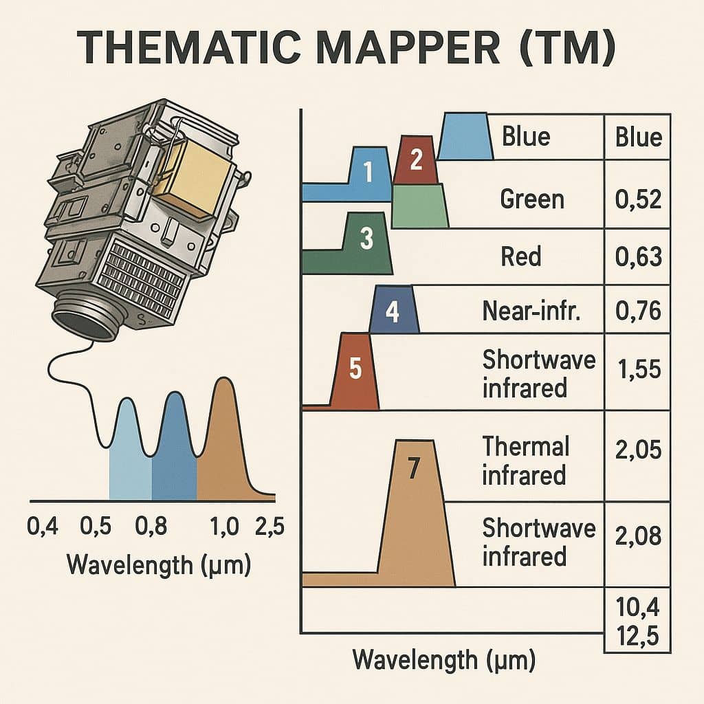
ASTER Satellite Sensor ASTER stand for Advanced Spaceborne Thermal Emission and Reflection Radiometer, it is operating on the Terra spacecraft. The Terra satellite launched in December 1999 as part of NASA’s Earth Observing System (EOS), a Sun-synchronous polar orbit. ASTER is a cooperative effort between NASA, Japan’s Ministry of Economy, Trade and Industry (METI), and […]

ASTER Satellite Read More »

Panchromatic Imagery

Panchromatic Image

Panchromatic Sensor in Remote Sensing The Panchromatic (PAN) Sensor had 5.8 m spatial resolution, as well as stereo capability. Its swath width is 70 m. Revisit time was every five days, with ± 26° off-nadir viewing. Panchromatic Band Band Wavelenth (µm) pan 0.5 to 0.75 Key Features of Panchromatic Image Feature Description Type Single band

Panchromatic Image Read More »

Hyperspectral Imagery

Hyperspectral Imaging

Hyperspectral Sensor Optical Sensors divided into 3 basic classes: Panchromatic, Multispectral, and Hyperspectral. Multispectral Sensor typically collects a few, wide (100-200 nm), and possibly noncontiguous spectral bands. Hyperspectral sensors typically collect hundreds of narrow (5-20 nm) contiguous bands. The name hyperspectral implies that the spectral sampling exceeds the spectral detail of the target. In practice,

Hyperspectral Imaging Read More »

Multispectral Imaging

Multispectral Imaging

Multispectral Imaging Sensor The Multispectral Scanner System (MSS) Sensor were line scanning devices observing the Earth perpendicular to the orbital track. The cross-track scanning was accomplished by an oscillating mirror; six lines were scanned simultaneously in each of the four spectral bands for each mirror sweep. The forward motion of the satellite provided the along-track

Multispectral Imaging Read More »

Thematic Mapper

Thematic Mapper

Summary: – The Thematic Mapper (TM) is a multispectral scanning sensor that was introduced aboard the Landsat 4 and Landsat 5 satellites. The TM sensor captures imagery in seven spectral bands, with a spectral and spatial resolution. Thematic Mapper Sensor: Landsat TM The Thematic Mapper (TM) is a powerful imaging sensor that was part of

Thematic Mapper Read More »

Scroll to Top