Create Geodatabase in QGIS
There are three ways you can open a Geodatabase file in QGIS.
- QGIS Browser
- Data Source Manager
- Drag and Drop
Open Geodatabase with QGIS Browser
Open a ESRI geodatabase file, using Browser.
1. Open QGIS, look at the Browser in the layer panel. If it doesn’t appear in your QGIS go to View, Panels and check Browser.
2. In the browser panel, browse to the ESRI geodatabase file. All the files in the geodatabase can be seen.
3. Next, Right click a file and select Layer Properties.
4. The Layer Properties window will appear, show all the data tabs.
5. To add a data in the geodatabase into a QGIS map, right click a file to be added and select Add Layer to Project or simply double click the file.
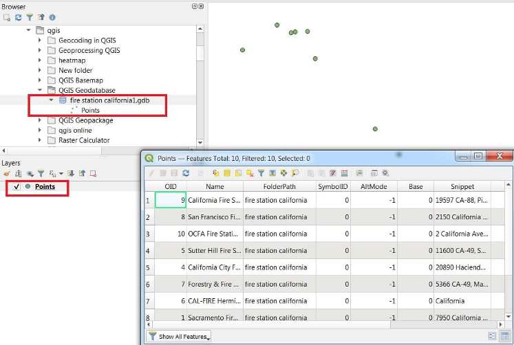
The selected file will be added to the QGIS map canvas.
Open Geodatabase with QGIS Data Source Manager
Open an geodatabase, using Data Source Manager.
1. From the Layer menu select Data Source Manager.
2. The data source manager window will appear, on the left panel, select Vector.
3. In the right side the options for vector data will appear, the Source Type select Directory. Then select OpenFileGDB and in the Vector Dataset(s) browse to the geodatabase.
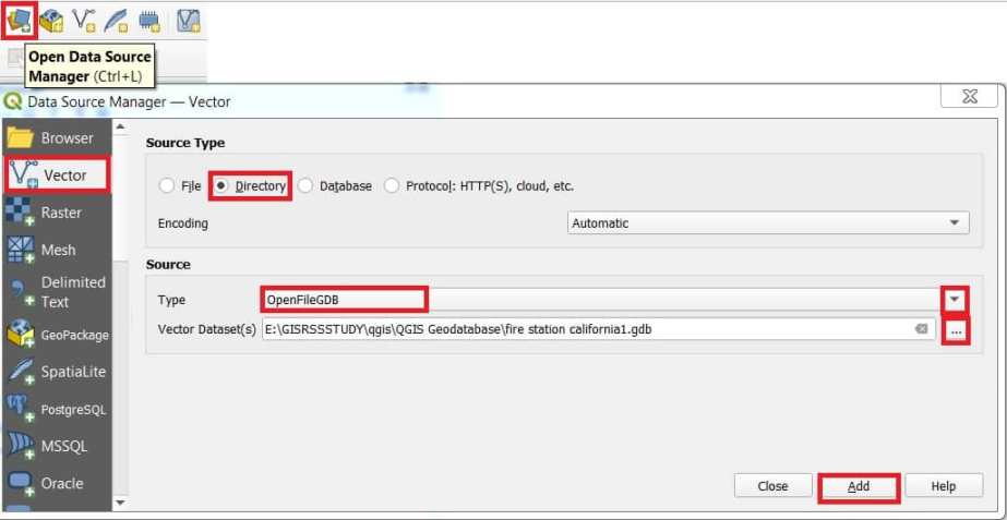
4. Finally click Add button to publish .gdb data.
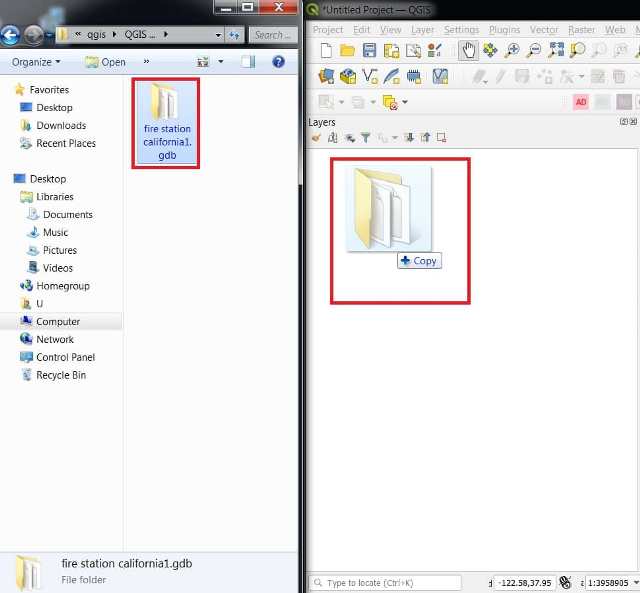
Open Geodatabase Drag and Drop
Open an geodatabase file, by drag and drop.
1. Open the browser file window in your system, and select a geodatabase.
2. Drag it into the QGIS layer panel, when the + icon appears over the layer panel, drop it.