GAGAN- GPS Aided GEO Augmented Navigation
Introduction GAGAN
GAGAN (GPS Aided GEO Augmented Navigation) is a Space Based Augmentation System (SBAS) developed by ISRO (Indian Space Research Organization) and AAI (Airports Authority of India). It is to provide the best possible navigational services over Indian Air Space.
GAGAN is a system of satellites and ground stations that provide GPS signal corrections, giving you better position accuracy. It’s implementation in two phases: I) GAGAN–TDS (Technology Demonstration System), II) GAGAN–OP (Operation Phase).
I. GAGAN – TDS
Ground Segment
- 8 INRES
- 2 INREEs
- 1 INMCC
- 1 INLUS
- 1 ring of OFC (7 INRES)
- 1 VSAT link (GPB)
Space Segment
- INMARSAT-4F1
II. GAGAN–OS
- GEO Satellites
- Uplink stations
- Control Centres
- Data communication networks
Application of GAGAN
- Satellite-based Navigation services with accuracy and integrity required for civil aviation applications over Indian Air Space
- Better Air Traffic Management over Indian Air space
- Indian Railways signalling
- Road Asset Management System (RAMS)
- Managed traffic in real time to avoid traffic jams
- Natural Resources, Forest and Land Management using GPS SXTREO-T51
- Forest management
- Scientific Research for Atmospheric Studies
- Using Mobile, Tourism, Aviation, etc
How It’s works?
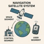
GPS Aided GEO Augmented Navigation system’s working with two segments, I) Ground/Control segment and II) Space segment.
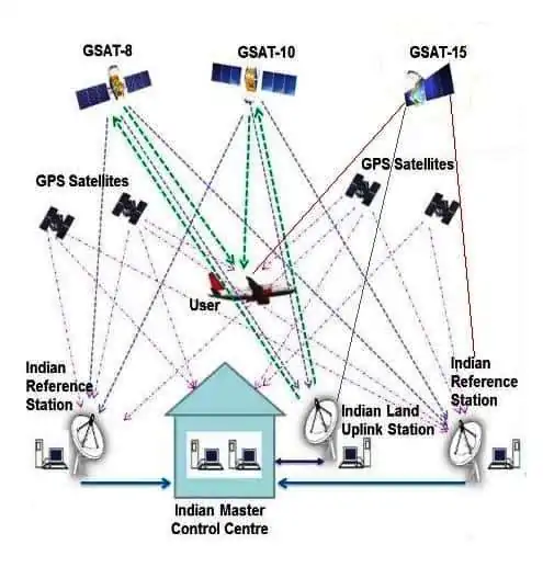
At present, the ground segment comprises 15 reference stations spread all over India and 3 major control centers. These reference stations are precisely chosen at any errors in the received GPS signals can be detected.
3 Geostationary communication satellites are: GSAT-8, GSAT-10 and GSAT-15.
SBAS GPS receiver can receive signal having correction messages as an additional source for the calculation of user’s position with accuracy better than 7.6 meters can be achieved.
Coverage Area
2 GEOs simultaneously transmit the GPS Aided GEO Augmented Navigation signal available in the space. GEO footprint expands from Africa to Australia and 45 reference stations for expansion to neighbouring countries.