Spatial Data Analysis in GIS
Spatial Data Analysis is one of the core components of Geographic Information Systems (GIS). It involves examining the locations, attributes, and relationships of features in spatial data through various analytical techniques. The goal is to extract meaningful patterns, trends, and insights that support decision-making and problem-solving.
Spatial Data Analysis involves examining the locations, attributes, and relationships of geographic features to gain meaningful insights and support decision-making.
Key Concepts in Spatial Data Analysis
| Term | Description |
|---|---|
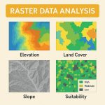
| Spatial Data | Data that includes geographic location (coordinates) and attributes. Two main types: vector (points, lines, polygons) and raster (grids or pixels). |
| Attribute Data | Descriptive information about spatial features (e.g., population, land use). |
| Topology | The spatial relationships between features (e.g., adjacency, connectivity). |
Types of Spatial Data Analysis
1. Descriptive Analysis
- Basic summary: counting features, area, length, etc.
- Example: total length of roads in a district.
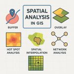
2. Overlay Analysis
- Combines multiple layers to find relationships.
- Example: intersecting land use and flood zones to find risk areas.
3. Buffering and Proximity Analysis
- Identifies features within a specified distance.
- Example: schools within 500 meters of highways.
4. Network Analysis
- Analyzes connectivity (roads, pipelines).
- Example: shortest route from ambulance station to hospital.
5. Spatial Interpolation
- Predicts values at unknown locations based on known data (mainly for raster).
- Example: estimating rainfall at unmeasured locations.
6. Hot Spot / Cluster Analysis
- Identifies areas of high concentration.
- Example: clustering of disease outbreaks.
7. Terrain and Surface Analysis
- Analyzing elevation, slope, aspect using Digital Elevation Models (DEM).
- Example: identifying suitable areas for agriculture based on slope.
8. Temporal Analysis
- Examines spatial change over time.
- Example: urban expansion from satellite images over 20 years.
Spatial Data Exploration
Spatial data exploration involves interacting with a collection of data and maps, which enables you to visualize and explore geographic information and analytical results.
The Spatial data exploration involves working with interactive maps and related tables, charts, graphs, and multimedia. This integrates the geographic perspective with statistical information in the attributes. It’s an iterative process of interactive exploration and visualization of maps and data.
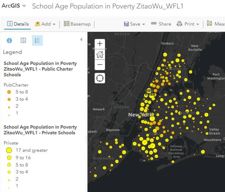
Spatial Data Analysis in ArcGIS
Mapping is one of the key ways that data exploration is carried out in ArcGIS webmap.
Download Spatial Data
Download free Geospatial Data for any country in the world.
Sources :
- DIVA-GIS
- Learn more about, how to Download Country Level Spatial Data.
- USGS- TNM Download
- Learn more about, how to Download Data & Maps from The National Map Viewer.
- Open Street Map (Geofabrik’s)
Download Spatial Data From Open Street Map
The best source to download Geo-Spatial Data is Open Street Map (Geofabrik’s).
Geofabrik’s is a free download server has data extracts from the OpenStreetMap project.
Select your continent and then your country of interest. See the steps below:
1. Once you have open Geofabrik’s server, see the available continent list.
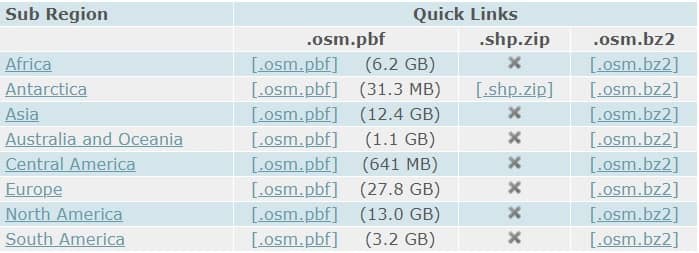
2. Click your require Sub Region (eg.- North America)
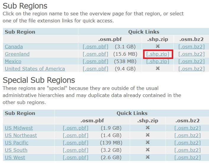
3. Now open the North America page, select Region, and click [.shp.zip] (eg.- Greenland).
4. Your data download in ZIP archive file format.
5. Once you have extract the zip file, show all the Spatial (Shapefiles/Vector) GIS data.