ENVI Software: Download, Install, and Analyze
Introduction
ENVI, which stands for Environment for Visualizing Images, is a powerful and widely used software developed by L3Harris Geospatial Solutions, launch in 1994. It is specifically designed for the visualization, processing, and analysis of geospatial imagery obtained from satellites, drones, and airborne sensors. ENVI has become an essential tool for professionals and researchers working in the field of Remote Sensing and Geographic Information Systems (GIS).
The software is particularly valued for its user-friendly interface, comprehensive toolset, and ability to work with a wide variety of image formats and sensor types. It supports tasks ranging from basic image enhancement and correction to advanced classification, feature extraction, and machine learning applications.
ENVI is extensively used in many fields, including agriculture, forestry, environmental science, geology, urban planning, disaster management, and defense. One of its main advantages is that it allows users with little programming experience to perform complex image analyses through its graphical tools and pre-built workflows. At the same time, it also offers advanced capabilities for expert users through scripting and automation.
Overall, ENVI provides a reliable, efficient, and professional solution for extracting meaningful and accurate information from remotely sensed data, helping decision-makers, researchers, and analysts to better understand and manage our environment and resources.
Usage:
- Use ENVI to fuse radar, LiDAR, SAR, optical, Hyperspectral, Multispectral, stereo, thermal and/or acoustic data to exploit the strengths of each sensor and create rich geospatial products for informed decision making.
- Its works with any size data set and has automated tools to quickly and easily prepare big and small imagery for viewing or further analysis.
- Using ENVI to perform batch processing or effortlessly create custom image processing workflows without having to write a single line of code.
Download ENVI Software
Now Download the ENVI Remote Sensing Software and install it. It’s supporting more than 200 different types of data.
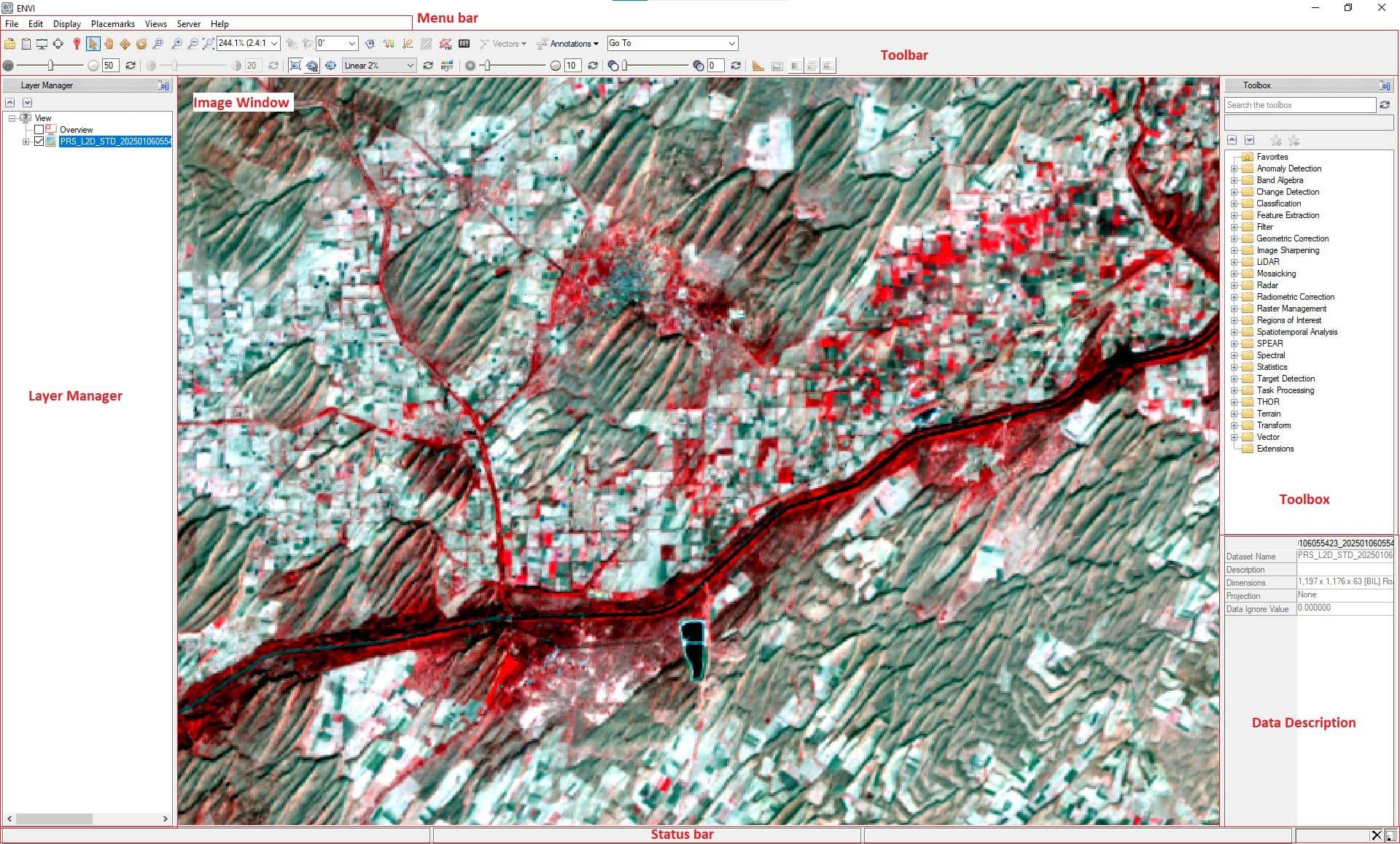

1. Open file, Data Manager, Chip to
PowerPoint (Report Generation)
2. Scroll View, Cursor Value, Select,
Pan, Fly, Rotate
3. Zoom, Fixed Zoom In/Out, Full
Extent, Percent/Ratio
4. North Up, Type or Preset Angle
5. Arbitrary/Spectral Profile, Scatter
Plot, ROI, Feature Count
6. Digitizing, Vectors, Enhanced
Annotations
7. Go To Coordinate
8. Brightness
9. Contrast
10. Histogram Stretch
11. Sharpen
12. Transparency, Mensuration
Portal, Blend, Flicker, Swipe
13. Mensuration Tools
ENVI Classic tutorials and associated data files are available from ENVI official website, learn all ENVI Tutorials.
Core Applications of ENVI (Tutorial)
ENVI is designed to handle end-to-end workflows for geospatial image analysis. The following sections detail the key applications and capabilities:
Hyperspectral Data Analysis
Hyperspectral imaging captures detailed spectral signatures across hundreds of narrow, contiguous bands, offering a fine-grained view of the Earth’s surface. This makes it possible to distinguish between materials such as minerals, vegetation species, pollutants, and man-made objects with high precision.
ENVI is globally regarded as one of the most powerful platforms for hyperspectral data analysis, particularly for sensors like AVIRIS, PRISMA, HyMap, Hyperion, and DESIS.
1. Data Import and Management:
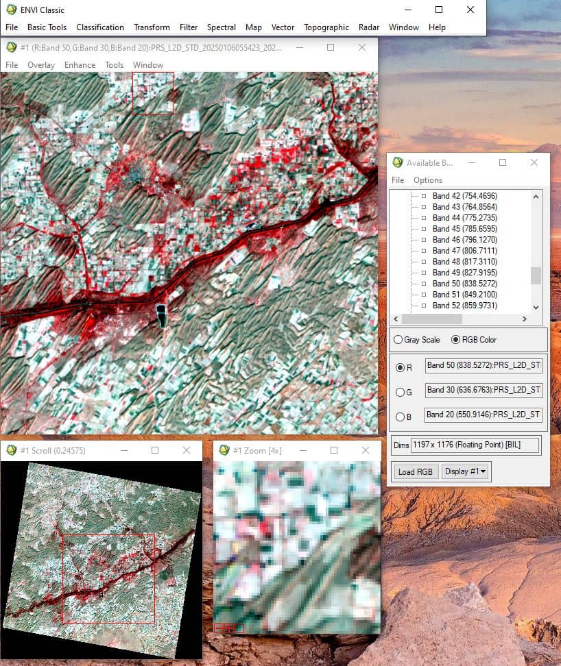
ENVI supports multiple hyperspectral data formats including:
- BSQ, BIL, BIP (common interleaved formats)
- HDF, NetCDF (scientific data formats)
- Sensor-specific formats for AVIRIS, PRISMA, HyMap, and others
Metadata is automatically extracted to provide essential calibration and acquisition parameters, ensuring accurate downstream analysis.

2. Preprocessing and Noise Reduction:
Raw hyperspectral data must be calibrated and denoised before scientific interpretation. ENVI offers integrated preprocessing workflows, including:
- Radiometric Calibration: Converts DN (Digital Number) values to physical units like radiance or reflectance using sensor-specific calibration metadata.
- Atmospheric Correction: Uses models like FLAASH (Fast Line-of-sight Atmospheric Analysis of Spectral Hypercubes) and QUAC (Quick Atmospheric Correction) for accurate reflectance retrieval.
- Destriping and Spectral Subsetting: ENVI includes tools to remove systematic noise and to focus only on relevant spectral bands for your application.
- MNF Transformation: The Minimum Noise Fraction transform is a key hyperspectral preprocessing tool that segregates noise-dominated components from signal-rich data, helping enhance spectral fidelity.

ENVI’s Competitive Edge in Hyperspectral Analysis
ENVI stands out due to:
- Pixel-Level Spectral Matching
- Rich Spectral Library Integration
- Automated Atmospheric Corrections for Hyperspectral Sensors
- Advanced Dimensionality Reduction and Noise Filtering
These capabilities make it an industry-standard tool in sectors like mineral exploration, military reconnaissance, precision agriculture, and environmental monitoring.
Spectral Analysis
Spectral analysis is at the heart of hyperspectral image interpretation. Unlike traditional multispectral data, hyperspectral imagery allows for highly discriminative material identification by analyzing subtle differences in spectral signatures across hundreds of bands.
ENVI offers an extensive suite of spectral analysis tools that allow users to explore, compare, and classify surface materials based on their spectral response.
Key Features:
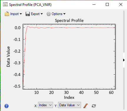
Spectral Profiles: Users can extract and visualize the reflectance or radiance curve for individual pixels or regions of interest (ROIs) across all bands. This is crucial for identifying and characterizing vegetation health, mineralogy, water quality, and more.
Spectral Angle Mapper (SAM): A classification technique that compares the angle between the image spectrum and reference spectra in a spectral space. It’s highly effective in discriminating materials irrespective of brightness variations.
Mixture Tuned Matched Filtering (MTMF): Allows sub-pixel detection by isolating specific materials even when they are mixed with others within a pixel.
Spectral Library Matching: ENVI supports both built-in and user-defined spectral libraries (e.g., USGS, ECOSTRESS), enabling rapid material identification by matching image spectra to known reference spectra.
Continuum Removal and Absorption Features: Advanced methods to normalize and isolate absorption features for in-depth material characterization (useful in vegetation analysis, geology, and water studies).
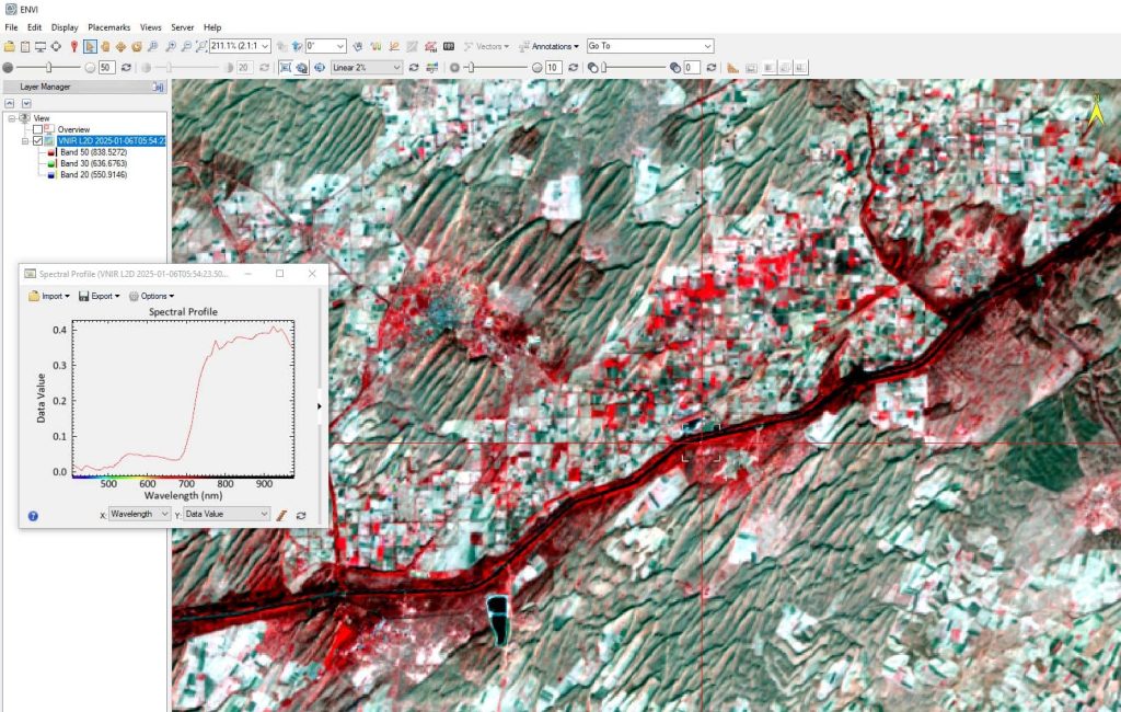
Image Sharpening
Spatial resolution is critical when identifying fine features such as narrow roads, small vegetation patches, or built-up details. However, hyperspectral sensors often provide coarser spatial resolution. To overcome this, image sharpening techniques are used to fuse high-spectral and high-spatial data.
Techniques and Tools in ENVI:
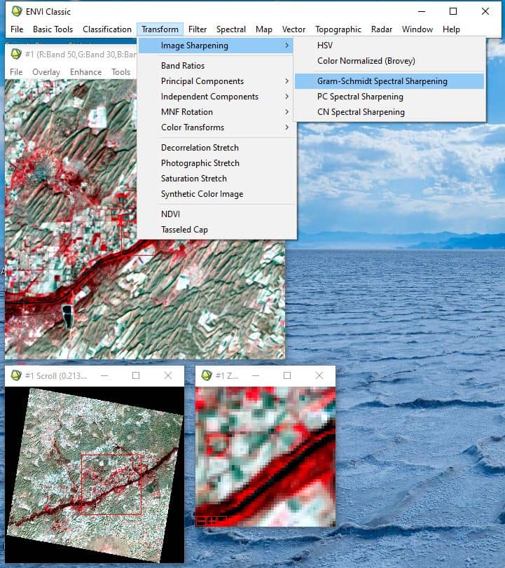
Pan Sharpening: This method fuses a high-resolution panchromatic image with lower-resolution hyperspectral/multispectral data. ENVI supports multiple algorithms such as:
- Brovey Transform
- Gram-Schmidt Spectral Sharpening
- Principal Component-based Fusion
Resolution Merge: Ideal for combining datasets such as Sentinel-2 with higher-resolution imagery like WorldView-2, enhancing visual interpretability and classification accuracy.
Image Filtering Tools: ENVI also includes sharpening filters like high-pass filters, edge detection, and spatial convolution to emphasize boundaries and features.
Benefits:
- Improves feature detection
- Enhances classification accuracy
- Enables fine-scale analysis without sacrificing spectral fidelity

Dimensionality Reduction and Feature Extraction
Hyperspectral images often contain over 100-200 spectral bands. While this rich data source increases analytical capability, it also introduces data redundancy, noise, and computational overhead. Dimensionality reduction is the process of reducing the number of input bands while preserving significant variance and feature information.
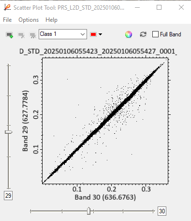
1. Band Correlation Analysis:
Before applying dimensionality reduction techniques, it is essential to understand the correlation structure within hyperspectral data. Hyperspectral images typically exhibit high correlation between adjacent spectral bands due to:
- Spectral Continuity: Adjacent wavelengths often capture similar surface material properties
- Atmospheric Effects: Atmospheric scattering and absorption affect neighboring bands similarly
- Sensor Characteristics: Overlapping spectral response functions between adjacent bands
- Physical Properties: Most natural materials have gradually changed spectral signatures across wavelengths
This high inter-band correlation results in:
- Data Redundancy: Similar information is captured across multiple bands
- Computational Inefficiency: Processing hundreds of correlated bands increases computational load
- Noise Amplification: Correlated noise patterns can propagate across multiple bands
- Storage Requirements: Large file sizes due to redundant spectral information
Understanding band correlation patterns helps justify the need for dimensionality reduction techniques and guides the selection of appropriate methods. Correlation analysis also helps identify:
- Bands with unique information content
- Spectral regions with high redundancy
- Optimal band combinations for specific applications
- Noise-dominated spectral regions that should be excluded
2. Dimensionality Reduction Tools in ENVI:
Principal Component Analysis (PCA)
What it does: Transforms the original correlated bands into uncorrelated principal components (PCs), each representing a direction of maximum variance. This transformation is particularly effective for hyperspectral data due to the high correlation between bands.
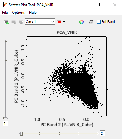
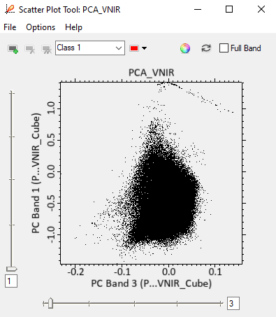
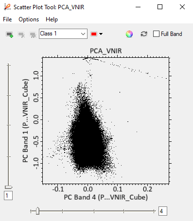
Use Cases:
- Detecting change or anomalies
- Enhancing features like water bodies, burned areas, or geological formations
- Noise reduction
- Data compression while preserving information content
Minimum Noise Fraction (MNF) Transformation
How it works: A two-step process that first estimates noise statistics and then applies PCA-like transformation. Unlike PCA, MNF orders the bands by signal-to-noise ratio, helping users focus only on signal-rich components.
ENVI Integration: The MNF tool in ENVI provides easy selection of valid bands and previews of eigenimages.
Independent Component Analysis (ICA)
Purpose: Extracts statistically independent sources from mixed data—especially useful when features of interest are subtle or masked.
Applications:
- Detecting oil spills
- Mineral mapping
- Identifying buried archaeological features
Classification and Thematic Mapping
Classification is the process of categorizing image pixels into land cover or material types based on their spectral and spatial properties. ENVI provides an advanced classification environment suited for both traditional and machine learning-based methods.
Classification Approaches:
1. Supervised Classification:
Involves training the algorithm with labeled samples (ROIs). ENVI supports:
- Support Vector Machines (SVM) – Ideal for high-dimensional data like hyperspectral imagery; handles nonlinear boundaries well.
- Random Forest – An ensemble method known for robustness and high accuracy.
- Maximum Likelihood Classification (MLC) – A classic statistical approach assuming Gaussian distribution.
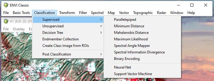
ENVI provides interactive tools for training data collection, confusion matrix generation, and validation.
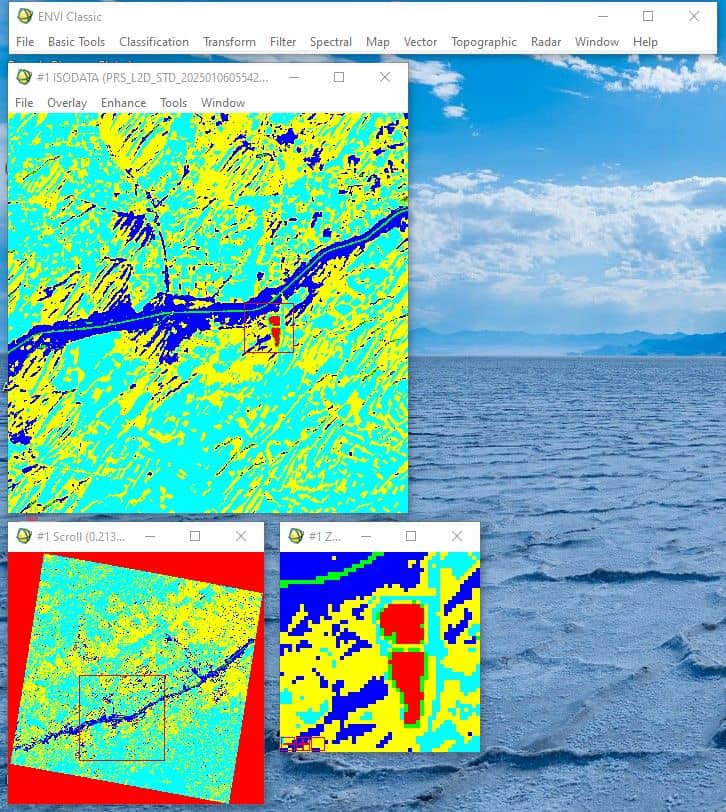
2. Unsupervised Classification:
Clusters pixels based on inherent spectral similarities. Popular methods in ENVI include:
- K-Means – Clusters data into k predefined groups
- ISODATA (Iterative Self-Organizing Data Analysis Technique Algorithm) – Adaptive clustering that modifies class count during iteration
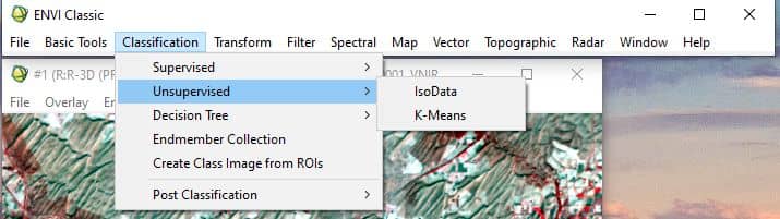
Unsupervised classification is useful when prior knowledge of the study area is limited.
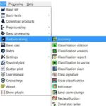
Post-Classification Tools:
- Accuracy Assessment: Generates confusion matrices, kappa statistics, and user/producer accuracy
- Change Detection: Compare classifications over time for dynamic monitoring
- Rule-Based Classification: Combine spectral, spatial, and textural rules for object-based image analysis (OBIA)
Applications:
- Land Use/Land Cover (LULC) Mapping
- Vegetation Typing
- Water Body Delineation
- Geological Mapping
Comparison with Other Image Processing Platforms to ENVI
| Feature | ENVI | ERDAS Imagine | QGIS (with Plugins) | Google Earth Engine |
| License Type | Commercial | Commercial | Open Source | Free (cloud-based) |
| Sensor Compatibility | Extensive (Optical, Radar, LiDAR, Hyperspectral) | High | Plugin-dependent | Very High |
| Ease of Use | GUI-based, intuitive | Moderate | Moderate | Code-heavy (JS/Python) |
| Hyperspectral Tools | Advanced | Limited | Rare via plugins | None (limited bands only) |
| Preprocessing Tools | Fully integrated GUI tools | Yes | Plugin-based | Code-based |
| Machine Learning | Built-in + Customizable | Basic | Plugin-dependent | Advanced (but coded) |
| 3D & LiDAR Integration | Yes | Yes | Limited | Limited |
While platforms like Google Earth Engine offer powerful cloud-based processing and QGIS excels in customization, ENVI remains the top choice for projects requiring scientific-grade analysis, particularly where spectral precision and advanced preprocessing are critical.
Advantages of Using ENVI
✅ All-in-One Environment: Combines data import, correction, classification, and analysis in a unified interface.
✅ User-Friendly Yet Powerful: Ideal for both non-coders and scripting professionals via IDL and ENVI Modeler.
✅ Scientific Accuracy: Trusted by researchers and defense analysts for high-fidelity spectral analytics.
✅ Strong Vendor Support: L3Harris offers regular updates, documentation, and community assistance.
✅ Modular and Scalable: Works standalone or integrates with ArcGIS, ERDAS, and enterprise geodatabases.
Real-World Applications Across Sectors
| Sector | Applications |
| Agriculture | Crop health monitoring, disease detection, yield prediction |
| Forestry | Canopy height modeling, biomass estimation, fire susceptibility mapping |
| Urban Planning | Land use monitoring, infrastructure change detection |
| Environment | Wetland mapping, pollution tracking, land degradation analysis |
| Disaster Management | Flood mapping, landslide assessment, damage extent analysis |
| Defense & Security | Terrain characterization, surveillance, object recognition |
Challenges and Considerations
- While ENVI offers unparalleled capabilities, it comes with some constraints:
- High Licensing Cost: May limit access for independent researchers or small organizations.
- Learning Curve: Despite GUI tools, mastering full functionality requires time and training.
- Hardware Requirements: Large datasets demand significant processing power and memory.
- However, for those who can invest in the platform and its learning, ENVI remains one of the most reliable and scientifically rigorous tools available.
Conclusion
ENVI is not just another remote sensing tool—it is a professional geospatial analytics platform trusted by experts worldwide. Its dominance in hyperspectral analysis, robust preprocessing workflows, and seamless integration with multi-source data make it an indispensable asset in scientific research, defense, environmental monitoring, and resource management. While alternatives exist, ENVI’s depth, reliability, and precision make it the benchmark software for advanced image analysis in remote sensing.